Subject: Atlases
Period: 1830 (published)
Publication:
Color: Hand Color
Size:
9.3 x 11.5 inches
23.6 x 29.2 cm
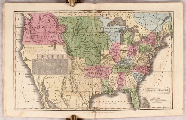
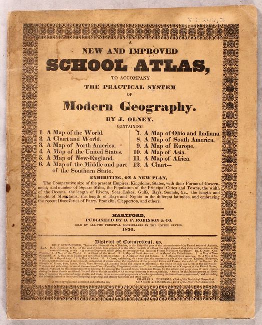
This school atlas contains 9 single-page maps and 2 double-page maps of the United States and the world dated 1828-1830. Of particular interest is the double-page map of the United States with early and interesting western territorial configurations. It shows Texas as part of Mexico, prior to it becoming a republic in 1836. The northern portion of Upper California is marked Unexplored Region, with much of the Southwest conveniently covered by a table of distances. The huge Oregon Territory extends to the Continental Divide and well north into British America, reflecting the United States' claims in this region. East of Oregon is the large and convoluted Missouri Territory that stretches between the Canadian border down to a large Arkansas Territory. The map is filled with information on forts, Indian tribes, rivers, and topography.
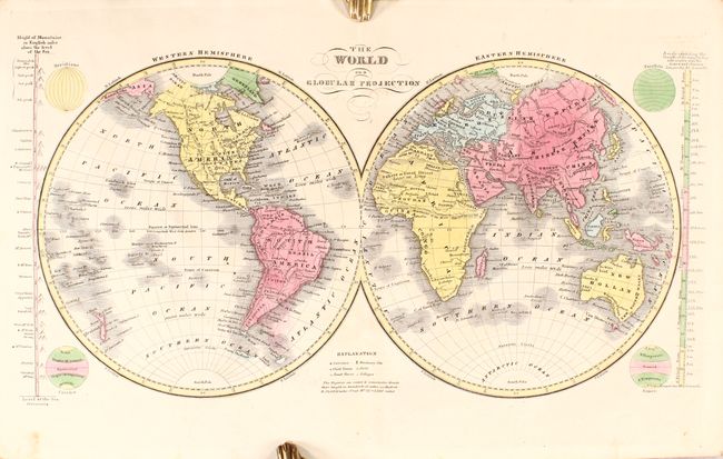
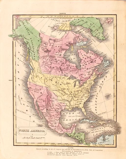
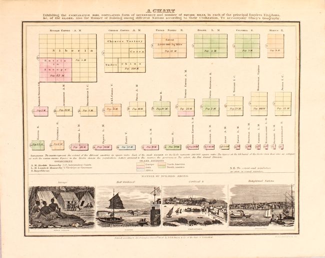
Maps included in the atlas are: world in hemispheres (double), world with thematic chart of religions, North America, United States (double), New England, Middle States and Part of the Southern States, Ohio & Indiana, South America, Europe, Asia, and Africa. Also includes an interesting chart at the back showing the comparative land size, population and forms of government for various countries with four engraved vignettes including Canton ("Half Civilized"), Constantinople ("Civilized") and Philadelphia ("Enlightened Nation"). Published by D.F. Robinson & Co.
References:
Condition: A
The maps are very good to mostly near fine with occasional light offsetting. Paper wrappers have some light soiling.