Subject: Southern Africa & Madagascar
Period: 1740 (dated)
Publication:
Color: Hand Color
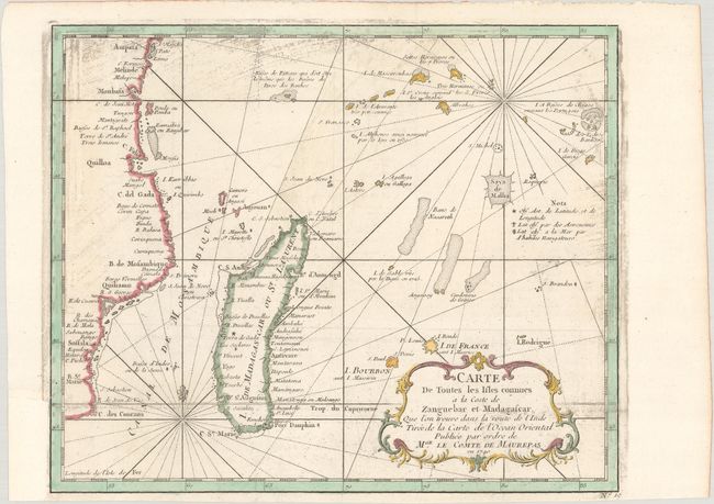
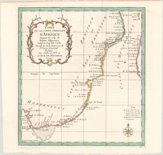
This lot includes two Bellin maps of Southern Africa and Madagascar commissioned by Jean-Frédéric Phélypeaux, Count of Maurepas.
A. Carte de Toutes les Isles Connues a la Coste de Zanguebar et Madagascar..., (11.1 x 9.2"). This chart focuses on the numerous islands off the southeastern coast of Africa, including Madagascar, the Comoros Islands, Reunion and Mauritius, and the Seychelles. The coastline of Mozambique is also shown. There is good detail of shoals, rocks, and other navigational hazards.
B. Carte de la Coste Orientale d'Afrique Depuis le Cap de Bonne Esperance Jusqu'au Cap del Gada..., (8.9 x 9.6"). This map shows the southeastern coastline of Africa from C. del Gada in Tanzania to the Cape of Good Hope, with the western coast of Madagascar included. Decorated with an ornamental title cartouche featuring scroll motifs and a compass rose.
References:
Condition: B+
Both maps are issued folding on watermarked paper with <i>Brandenburgische Landeshochschule</i> stamps on verso and binding trims in the bottom left margin that have been replaced with old paper. The first map has printer's ink residue, and there is minor offsetting on the second map.