Subject: Western Hemisphere - America
Period: 1819 (dated)
Publication:
Color: Hand Color
Size:
30.3 x 20.6 inches
77 x 52.3 cm
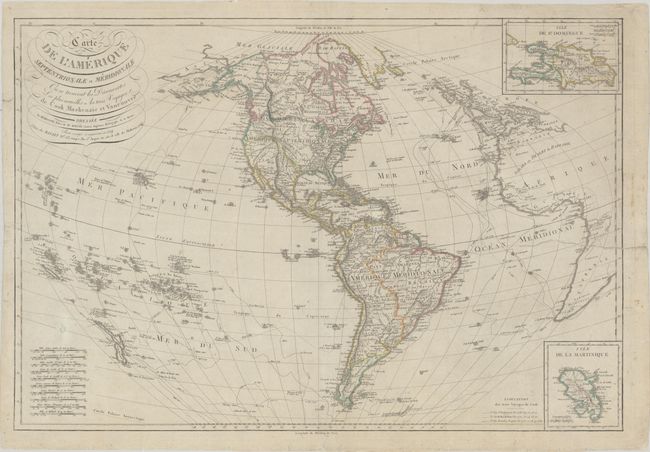
This very scarce copper-engraved map of the Western Hemisphere showcases the discoveries of Cook, Mackenzie, and Vancouver, delineating the tracks of Cook's voyages. Based on the cartography of Rigobert Bonne, this map is a corrected and updated version of a large map first published by Basset in 1795. It extends in the west to include New Zealand and the many islands of the South Pacific and in the east to cover Western Europe and the western coast of Africa. There is nice topographical detail, and several Indian tribes and towns and cities are named in the Americas. North America is also called Colombie. A large Lousiana Territory appears west of the Mississippi, and present-day Texas, California, and the rest of the American Southwest are still part of Mexico. In the Pacific Northwest the Oregon boundary dispute is reflected in an unusual boundary following the Columbia River. There are two insets at right: Isle de St. Domingue and Isle de la Martinique. The title is in decorative lettering at top left. Ten distance scales fill the bottom left corner.
References:
Condition: B
Several edge tears have been closed on verso with archival material, with one that extends 7.5" into the map image at right. There is light soiling, a small repaired hole above the distance scales, and a tiny tear in the Gulf of Mexico.