Subject: Western Hemisphere - America
Period: 1720 (circa)
Publication:
Color: Black & White
Size:
21 x 16.9 inches
53.3 x 42.9 cm
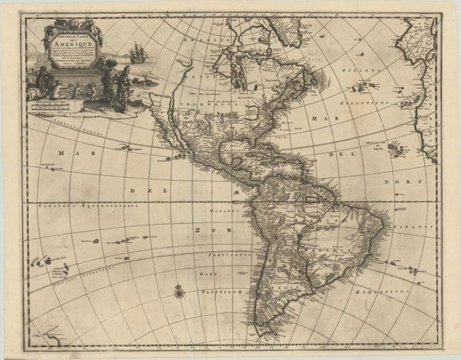
Van der Aa's uncommon map of the Americas was first issued in 1714, and includes interesting geographical myths. In North America California is depicted as an Island in the early Sanson form with a nearly flat top beginning at C. Mendocina. Nova Albion is noted in the northern part of the island, and Village des Canots has been inserted between P. de Carinde and P de la Conception. The northwest coast is indented with the Straet Anian separating the continent from Anian. The St. Lawrence River connects with a single large interior lake, which is open-ended in the west. South America is shown with the large, mythical interior lake Parime Lacus in Guyana and Lago de los Xarayes in the center of the continent. A partial outline of Zelandia Nova is shown in the South Pacific. The beautiful title cartouche features Natives trading New World products with European merchants.
References: Tooley (Amer) 72 (Plt #55); McLaughlin #187.
Condition: B+
A dark impression on a watermarked sheet with minor repairs along the top fold and some light printer's ink residue. Issued folding.