Catalog Archive
Auction 181, Lot 511

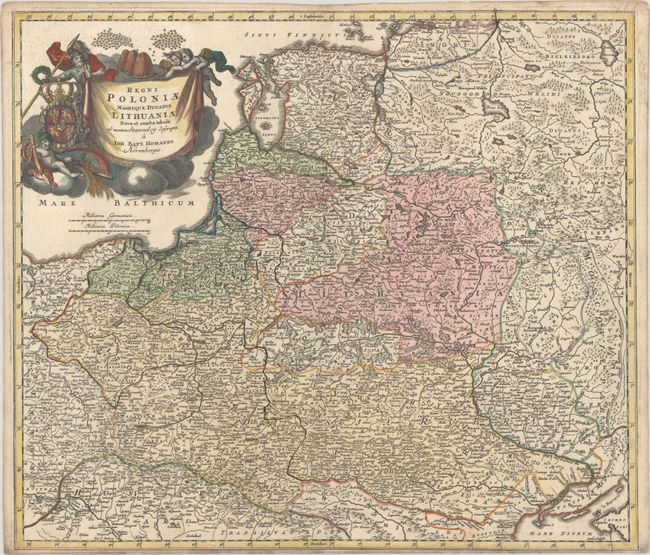
"Regni Poloniae Magnique Ducatus Lithuaniae Nova et Exacta Tabula ad Mentem Starovolcy Descripta", Homann, Johann Baptist
Subject: Eastern Europe, Poland

Period: 1716 (published)

Publication:

Color: Hand Color

Size:
22.4 x 19.4 inches
56.9 x 49.3 cm
Download High Resolution Image
(or just click on image to launch the Zoom viewer)

Homann's striking map covers Poland, Lithuania, Latvia, Estonia, and a portion of Russia, extending from St. Petersburg in the north to the Black Sea in the south. The map includes a lot of topographic detail and as well as the cities of Kiev, Minsk, Warsaw, and Vienna. A gorgeous allegorical cartouche fills the Baltic Sea and features Ares, god of war, holding both a spear and a laurel wreath; the Polish-Lithuanian coat of arms under Wettin dynasty; and beehives symbolizing industry. There is a visible crack in the plate at bottom right.

References:

Condition: B+

Contemporary color in the map with later color in the cartouche. There is light soiling and toning along the edges of the sheet, and the bottom margin is narrow, as issued.

Estimate: $400 - $475

Sold for: $550

Closed on 2/10/2021

Archived