Subject: Eastern Europe, Russia
Period: 1548 (published)
Publication: La Geografia di Claudio Ptolemeo Alessandrino
Color: Black & White
Size:
6.6 x 4.9 inches
16.8 x 12.4 cm
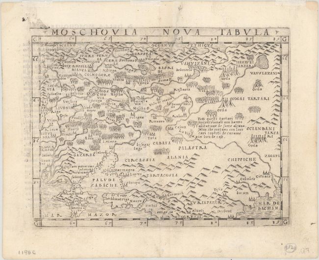
An early map that includes portions of present-day Latvia and Lithuania, Belarus and the Ukraine. Riga and Vilnius are both named, and the map is filled with pictorial representations of topography as well as small tents to represent Tartar camps. Italian text on verso.
With maps engraved on copper, Gastaldi's work was conceived as the first "pocket" or miniature atlas. His monumental work was the most comprehensive atlas produced between Waldseemuller's Geographiae of 1513 and Ortelius' Theatrum of 1570.
References: Mickwitz & Miekkavaara #214-38.
Condition: B+
On a bright sheet with a few worm holes and tracks at bottom. There is a bit of paper weakness to the right of the centerfold at top.