Subject: Black Forest, Rhine River
Period: 1681 (published)
Publication: The English Atlas
Color: Hand Color
Size:
32.2 x 17.6 inches
81.8 x 44.7 cm
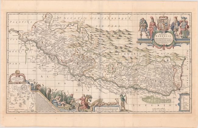
This decorative one-and-a-half sheet map centers on the Schwartz Wald or Black Forest region of Germany. The mountain range is pictorially represented. The course of the Rhine is prominently depicted as well, stretching from Speyer south to Basel and Laufenberg. A key in a cartouche at bottom right identifies villages, towns, and cities, monasteries, baths and thermal springs, mines, and more. The landscape is also covered with coats of arms. Another cartouche at bottom left features geometrical and mechanical figures and tables. It is surrounded by a vignette featuring a river god, a goddess with a cornucopia, a hunter with slain animals, horses in the reeds, and more. The elaborate title cartouche at top right includes numerous allegorical figures, a coat of arms, and a quote from Virgil. North is oriented to the left.
This was published in the second volume of The English Atlas. It includes the number "XL" at top right and a graticule that were not present on previous Jansson editions. The atlas was projected to be a 12-volume work in the tradition of the earlier Dutch atlases and was to use updated copperplates belonging to Johannes Jansson van Waesberge, son-in-law and heir of Jan Jansson. Only 4 volumes were completed before the venture failed and Pitt was thrown into debtor's prison.
References: Van der Krogt (Vol. I) #2630:1.2.
Condition: B+
A sharp impression on watermarked paper with some minor scattered foxing and light toning that is primarily confined to the blank margins.