Subject: Eastern Germany & Southwestern Poland
Period: 1642 (published)
Publication: Appendix
Color: Hand Color
Size:
20.6 x 16.1 inches
52.3 x 40.9 cm
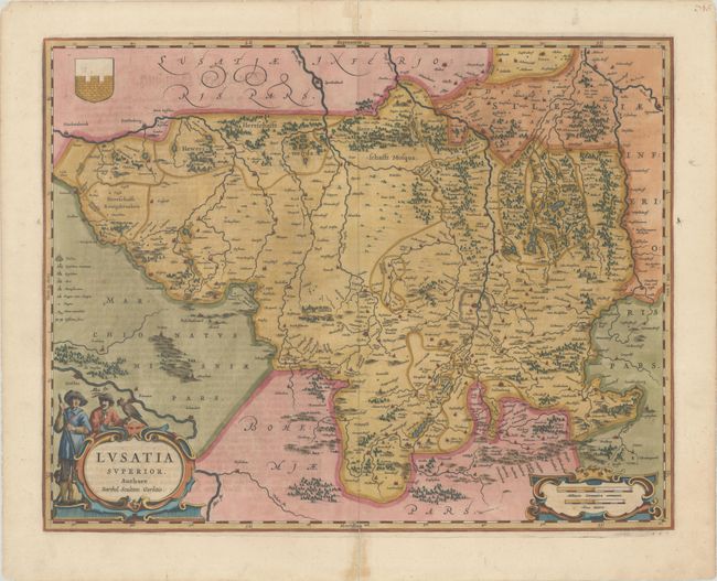
Attractive map of the historic region of Upper Lusatia, which was made up of the region where present-day Germany, Poland, and the Czech Republic intersect. The region fell primarily within the Saxony state in Germany. Old city names include Lieba, Gorlitz, Dresden, Pirnaw, and Prybus, and many tiny villages are identified as well. The map is fully engraved to show mountains and forests, and is decorated with title and distance scale cartouches and a coat-of-arms. The title cartouche features a hunter with a dog and a falconer with a handsome bird. German text on verso with page number 16.
References: Van der Krogt (Vol. II) #2882:2.
Condition: A
A fine impression with centerfold separations at top and bottom and an edge tear at top that have been repaired with archival materials on verso. There are a few minor spots of foxing.