Subject: Central Germany
Period: 1680 (circa)
Publication: The English Atlas
Color: Hand Color
Size:
21.7 x 17.6 inches
55.1 x 44.7 cm
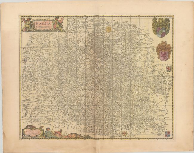
This decorative map of the Hesse-Kassel region, filled with scores of villages, forests, mountains, and rivers, is centered on Kassel and shows a large amount of detail on a scale of about one German mile per inch. The Anderloon Forest is to the southwest and Thuringia is to the east. Both the title cartouche and scale of miles are decorated with elaborate hunting scenes, and the map is further embellished with seven coats-of-arms of the various regions. Jansson copied the map from Blaeu. This example was published in Volume III of Pitt's The English Atlas, as indicated by the added graticule and page number "XXXI" at top right. Originally Pitt's atlas was intended to be a 12-volume set, but only four volumes were published before Pitt abandoned the project due to debt. Blank verso.
References: Van der Krogt (Vol. I) #2450:1C.2.
Condition: B+
Uneven light toning, especially concentrated along the centerfold and sheet's edges. There are centerfold separations and a couple of short edge tears in the blank margins.