Subject: Texas
Period: 1878 (dated)
Publication: Hanford's Texas State Register
Color: Hand Color
Size:
25.3 x 18.3 inches
64.3 x 46.5 cm
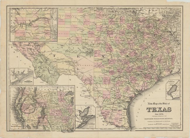
This scarce, separately published map of the state of Texas was included in Albert Hanford's Texas State Register for 1878 (not present). Published between 1856-1861 and 1867-1879, the Texas State Register was intended to encourage settlement in the state. The map reflects the rapid expansion that had taken place thus far with full county development replacing Young Territory in the panhandle. It features excellent detail of the expanding railroad network (existing and proposed), forts, roads, watershed and topography. Only the western portion of the state (El Paso, Presidio, Pecos) has limited development . Includes insets of Plan of the Northern Part or "Panhandle" of Texas, Plan of Matagorda Bay, Plan of Sabine Lake, and Western Portion of the United States. Copyrighted 1875 and "Prepared expressly for Hanford's Texas State Register."
References: cf. Taliaferro (Rosenberg) #352 & #367.
Condition: B+
Issued folding on thin paper with minor foxing. There are several archivally repaired small fold separations along the sheet edges, including one at lower left that extends 3.5" into the image with minor image loss.