Subject: North Carolina, Geology
Period: 1875 (circa)
Publication:
Color: Hand Color
Size:
27.3 x 14.1 inches
69.3 x 35.8 cm
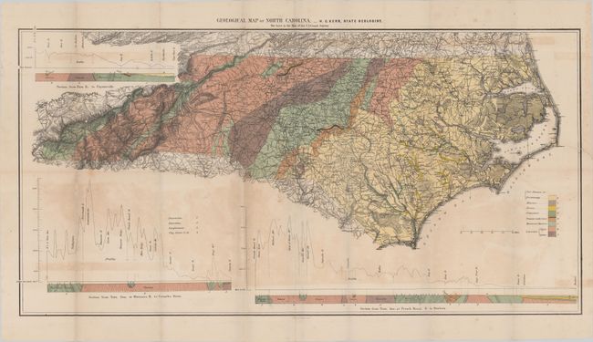
Although North Carolina established the first publicly funded geological survey in America in 1824, it was not until this report (some 50 years later) that the state published its first geological map. Compiled by State Geologist W.C. Kerr, the detailed map is color-coded to show eight different geological types including Cretaceous, Triassic, and Huronian among others. Surrounding the map are three detailed cross sections/topographic profiles of different parts of the state. The base map was provided by the U.S. Coast Survey.
References: Marcou & Marcou #593.
Condition: B
Issued folding with light toning and offsetting. There is a 1.5" edge tear at right and a few minor fold separations that have all been closed on verso with archival tape.