Catalog Archive
Auction 181, Lot 256

"Cours du Fleuve Saint Louis Depuis ses Embouchures Jusqu'a la Riviere d'Iberville et Costes Voisines", Bellin, Jacques Nicolas

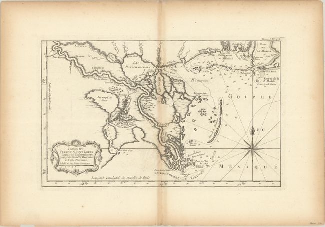
Subject: Colonial Louisiana, Mississippi River

Period: 1764 (circa)

Publication: Le Petit Atlas Maritime

Color: Black & White

Size:
13.9 x 8.5 inches
35.3 x 21.6 cm
Download High Resolution Image
(or just click on image to launch the Zoom viewer)

This is an uncommon map of the Mississippi River delta and the coastline to Mobile Bay. The map shows the course of the Mississippi up to the Iberville River, near present-day Baton Rouge, and also locates New Orleans, Lake Pontchartrain, Biloxi, and more. The English Turn (Detour des Anglois) is noted south of New Orleans. Decorated with a fine compass rose, rhumb lines with fleur-de-lys, and decorative title cartouche.

References: Lemmon, Magill & Wiese #30.

Condition: B+

On watermarked paper with light toning along the centerfold and sheet edges.

Estimate: $240 - $300

Sold for: $120

Closed on 2/10/2021

Archived