Subject: Hawaii
Period: 1960 (dated)
Publication:
Color: Printed Color
Size:
26.9 x 19.9 inches
68.3 x 50.5 cm
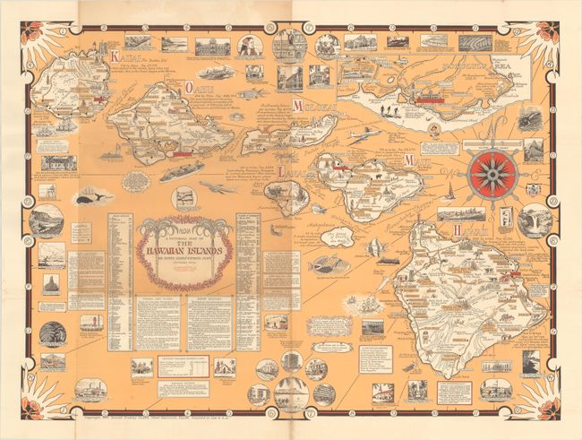
This pictorial map of the Hawaiian Islands was designed and drawn by Ernest Dudley Chase, and was issued shortly after Hawaii's statehood. Both decorative and practical, it identifies numerous place names along the coastlines, locates roads, and illustrates points of interest including Moana Loa, Haleakala Crater, and Pearl Harbor to name a few. The map is surrounded by additional illustrations relevant to visitors including Waikiki Beach, Dole Pineapple Company, and the Iolani Palace. Tables surrounding the title add perspective including a brief history, points of interest, holidays and festivals, and more. The composition is completed by a decorative title cartouche featuring palm trees and a compass rose filled with a ship's wheel.
Ernest Dudley Chase was a leader in pictorial mapmaking during the middle 20th century, and his ambitious works have great appeal to this day.
References: Hornsby (Picturing America) pp. 31-34; Rumsey #12332.
Condition: B+
Issued folding with some light toning primarily around the title cartouche and one fold, and a few spots of foxing along the fold lines.