Subject: San Diego, California
Period: 1888-91 (circa)
Publication: H.R. Ex. Doc. 14, 52nd Congress, 1st Session
Color: Printed Color
These three maps were included in a congressional report concerning the construction of a military post in San Diego, where defenses were limited up to this point.
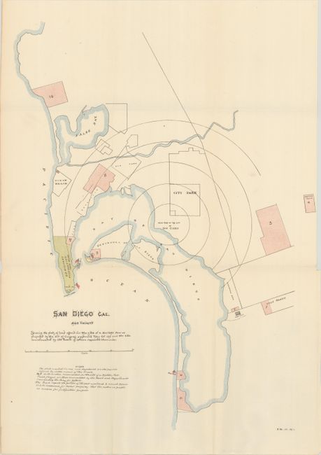
A. San Diego Cal. and Vicinity, dated 1891 (13.8 x 18.5"). A sketch map of the San Diego region with the U.S. Military Reservation shown above Point Loma (Ballast Point). Includes 11 areas shaded in pink to indicate possible sites for a military post, and small American flags indicate recommended batteries. The map locates Old Town, City Park, Otay City and more.
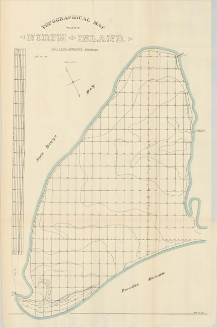
B. Topographical Map of North Island, dated 1888 (15.5 x 23.6"). A survey map of North Island completed by Miller and Briggs, Engineers (site #9 on the first map). Indicates the high tide line, flood tide line, and sandbar at the southwest corner of the island. Includes an elevation profile along the left sheet edge.
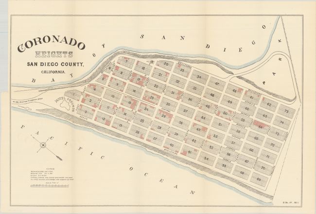
C. Coronado Heights San Diego County, California (20.1 x 13.1"). A detailed plan for the new community of Coronado Heights (incorporated in 1890) with the Hotel Grounds (Hotel del Coronado) prominently depicted. The new city quickly became a resort destination.
References:
Condition: A
Issued folding on clean sheets.