Catalog Archive
Auction 181, Lot 213

NO RESERVE

"[Lot of 2] Commercial Map of the Counties in the Arkansas River Valley [and] Arkansas River in the Vicinity of Fort Smith", U.S. Government

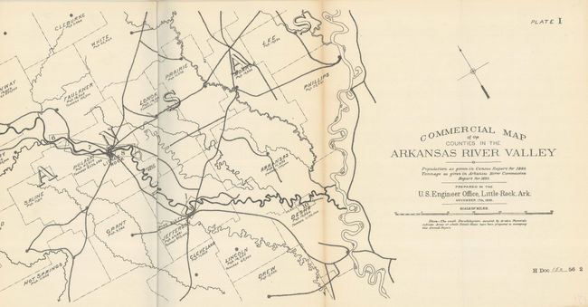
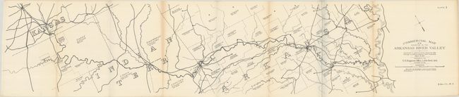
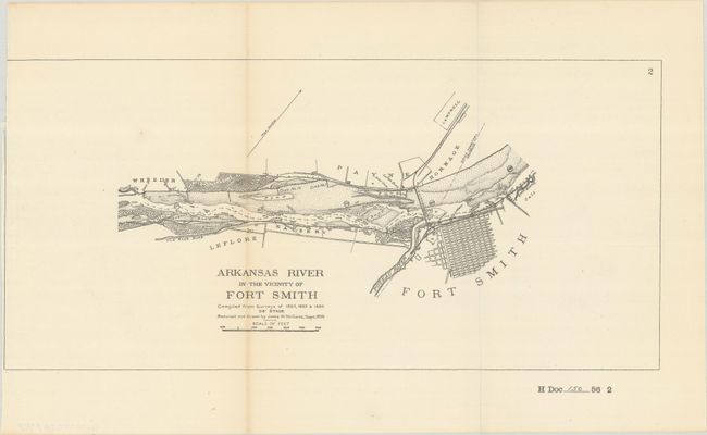
Subject: Arkansas River

Period: 1899 (dated)

Publication: H.R. Doc. 150, 56th Congress, 2nd Session

Color: Black & White

Size:
See Description
Download High Resolution Image
(or just click on image to launch the Zoom viewer)

These detailed maps are from a report on the examination and survey or the Arkansas River. The first map (41.0 x 8.5") spans from Wichita, Kansas, through Indian Territory and Arkanas, terminating at the Mississippi River. It delineates railroads and identifies Indian land and counties with population figures. The second map (13.6 x 6.4") centers on Fort Smith, established as a frontier military post in 1817. The city is shown in plan form, with nice detail of dikes and wharves.

References:

Condition: B+

Both maps issued folding. The first map has light toning and some minor extraneous creasing around the folds. The second map has minor toning along the left fold and part of the neatline has been trimmed away at top left.

Estimate: $50 - $70

Sold for: $4

Closed on 2/10/2021

Archived