Catalog Archive
Auction 181, Lot 203

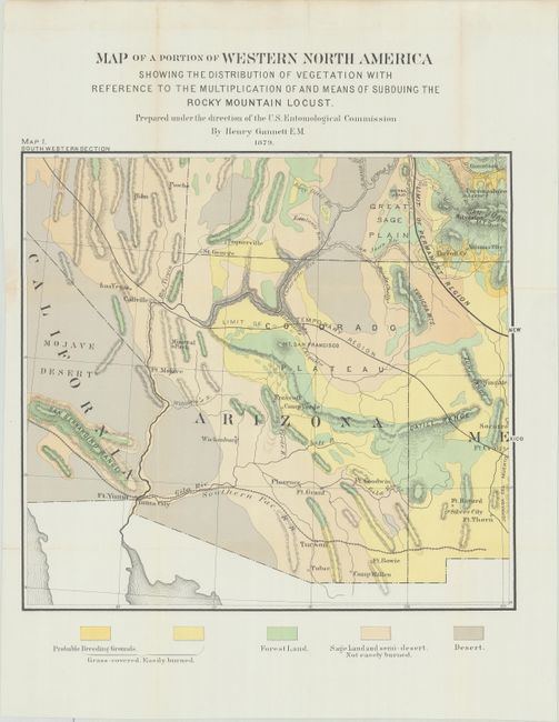
"Map of a Portion of Western North America Showing the Distribution of Vegetation with Reference to the Multiplication and Means of Subduing the Rocky Mountain Locust ... Map I. South Western Section", U.S. Government
Subject: Southwestern United States

Period: 1879 (dated)

Publication: Second Report of the U.S. Entomological Commission for 1878-1879

Color: Printed Color

Size:
15.3 x 14 inches
38.9 x 35.6 cm
Download High Resolution Image
(or just click on image to launch the Zoom viewer)

This interesting map centers on the territory of Arizona with portions of the surrounding states and territories. It was prepared by Henry Gannett under the direction of the U.S. Entomological Commission. The coloring illustrates vegetation type and the probable breeding grounds of the Rocky Mountain Locust. In 1875, this species was responsible for the largest recorded locust swarm in history – 1,800 miles long and 110 miles wide containing several trillion insects – causing wide-spread destruction of farms throughout the American West. The scourge prompted a concerted government effort to eradicate the insect. The map is a fine example of thematic mapping. Beyond the map’s stated purpose, it also provides an excellent view of topography, railroads, forts and towns.

References:

Condition: B+

Issued folding, now flattened and professionally backed in Japanese tissue to close some fold separations and a 3.5" edge tear at left. There is faint toning along some of the folds.

Estimate: $180 - $230

Sold for: $130

Closed on 2/10/2021

Archived