Subject: Southwestern United States
Period: 1864 (dated)
Publication: New Illustrated Family Atlas
Color: Hand Color
Size:
23.6 x 17 inches
59.9 x 43.2 cm
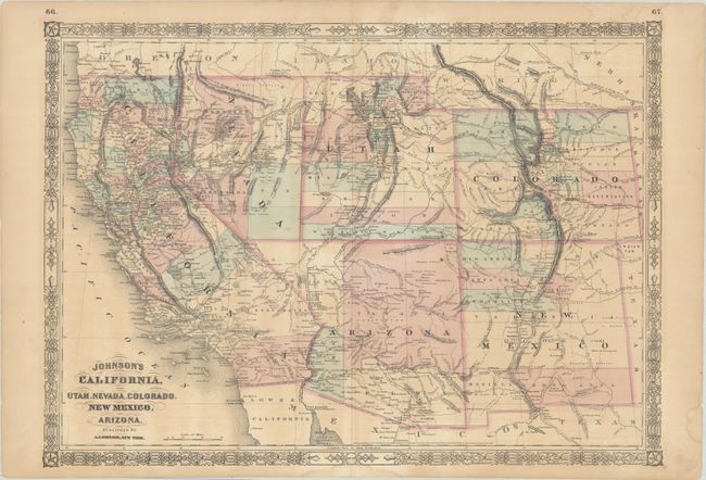
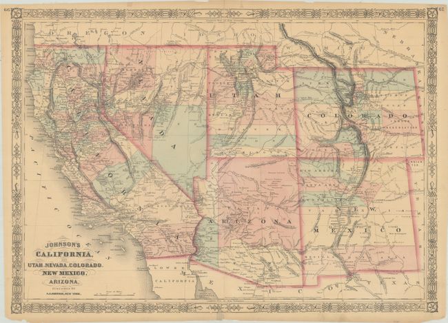
Johnson’s maps of the American Southwest occupy a temporal crossroads in the cartographic history of the United States after California statehood, before the adjacent territories formalized their boundaries, and before the transcontinental railroad was completed. The many different states of this map show dramatic and rapid changes. Besides the transitional territorial boundaries, the maps are of interest for the depiction of Pony Express routes, wagon trails, military expedition routes, the locations of gold and silver mines, Indian tribes, and much more relating to the geography and history of the region.
One of President Lincoln’s stipulations for signing the bill to establish Arizona Territory was that Tucson would not be the territorial capital and that it would be located in the northern part of the territory. These maps shows the territorial capital at the recently founded city of Prescott, near the mine fields of the Bradshaw Mountains.
The first map shows Arizona’s original four counties: Mojave, Yavapai, Yuma, and Pima. There are several new county developments in Nevada, Utah, and Colorado. The second map was issued shortly after Arizona ceded the region west of the Colorado River to Nevada formalizing both territories final boundaries. Although both maps feaure a 1864 copyright date, they were published in 1866-67.
References:
Condition: B+
Both maps feature contemporary color and are lightly toned. The first map has light dampstains that are mostly confined to the margins, some spots, and short edge tears in the margins that have been closed on verso with archival tape. The second map has several short tears into the border and one at right extending 1.5” into the map, all closed with archival tape.