Subject: Western United States
Period: 1853 (dated)
Publication: Mitchell’s A New Universal Atlas
Color: Hand Color
Size:
12.7 x 15.6 inches
32.3 x 39.6 cm
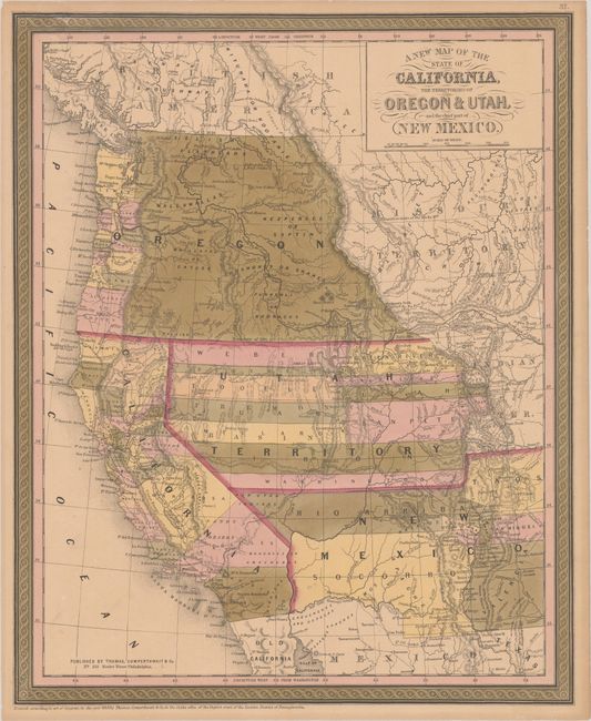
The era of continental expansion culminated with the Oregon Treaty of 1846 and the conclusion of the Mexican-American War in 1848 and was closely followed by the discovery of gold in California. Thus began a period of rapid exploration and growth in this huge region. Mitchell’s series of maps of the American West, published between 1846 and 1859, provide a fascinating view of the rapidly changing region.
The 1853 edition of this map, engraved on a new plate, expands the region depicted about 2 degrees further east to show more of New Mexico and Missouri Territory and part of Indian Territory. Oregon Territory now includes counties between the Pacific and the Cascade Mountains. Counties are also shown in Utah Territory. New Mexico Territory still encompasses parts of present-day Colorado and Arizona with its southern boundary on the Gila River in a pre-Gadsden Purchase configuration. Both Bartlett’s and Graham’s lines are noted, showing the disputed region.
References: Rumsey #3803.001
Condition: B+
Contemporary color on a lightly toned sheet with some oxidation of the green color that has not impacted the paper. A small chip at top left and an edge tear that just enters the border at bottom left have been repaired on verso with archival materials.