Subject: Central United States
Period: 1833-62 (circa)
Publication:
Color: Black & White
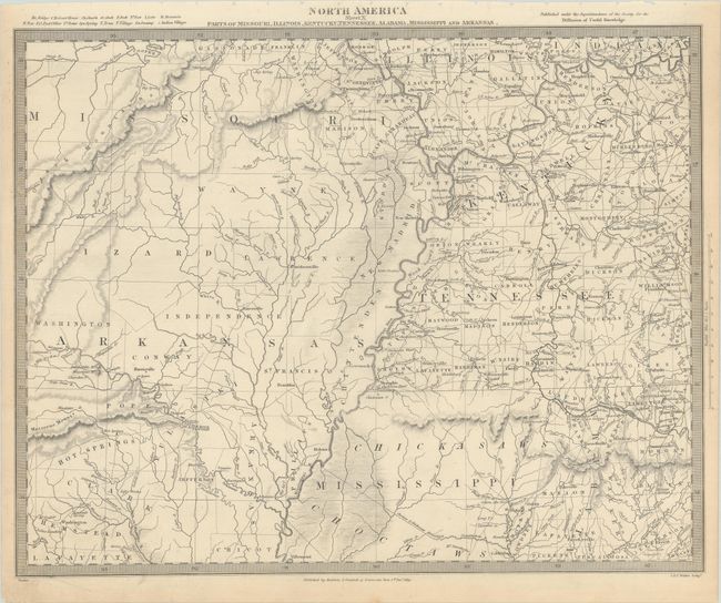
A. North America Sheet X Parts of Missouri, Illinois, Kentucky, Tennessee, Alabama, Mississippi and Arkansas, by SDUK Society for the Diffusion of Useful Knowledge, dated 1833 (15.5 x 12.4"). This detailed map shows the Mississippi River and Ohio River valleys. It spans from the Osage River in Missouri east to Rome, Indiana in the north and from the Red River in Arkansas to Elyton, Alabama in the south. Northern Mississippi is identified as lands of the Chickasaw and Choctaw tribes. Published by Baldwin & Cradock. A great map showing the extent of western immigration at this early point in U.S. history. Condition: There is minor toning and scattered foxing mostly confined to the sheet's edges. (A)
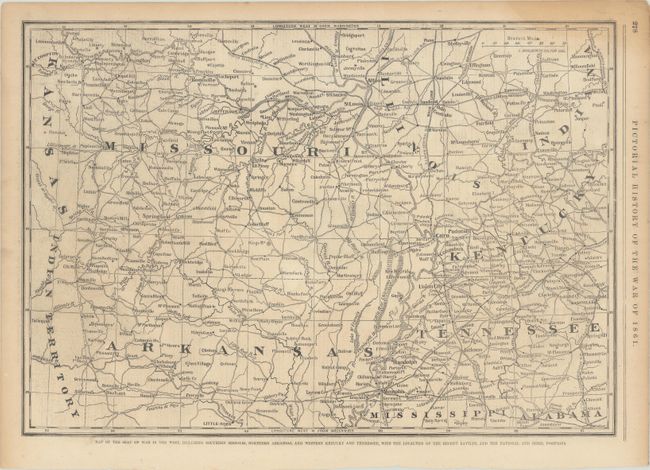
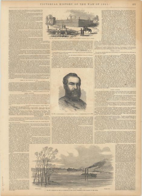
B. Map of the Seat of War in the West, including Southern Missouri, Northern Arkansas, and Western Kentucky and Tennessee…, by Frank Leslie, from Frank Leslie’s Pictorial History of the War of 1861, circa 1862 (19.9 x 13.9"). This Civil War map covers the western theater of the war, centering roughly on the Mississippi. It spans from the eastern borders of Kansas and Indian Territory east to Nashville. The map includes fine detail of the region's transportation network. The verso includes illustrations of Camp Chase in Columbus, Ohio, Major General James A. Garfield, and gunboats on the Tennessee River. Condition: There is a light damp stain at top right, minor soiling, and some toning along the sheet's edges. (B+)
References:
Condition:
See description above.