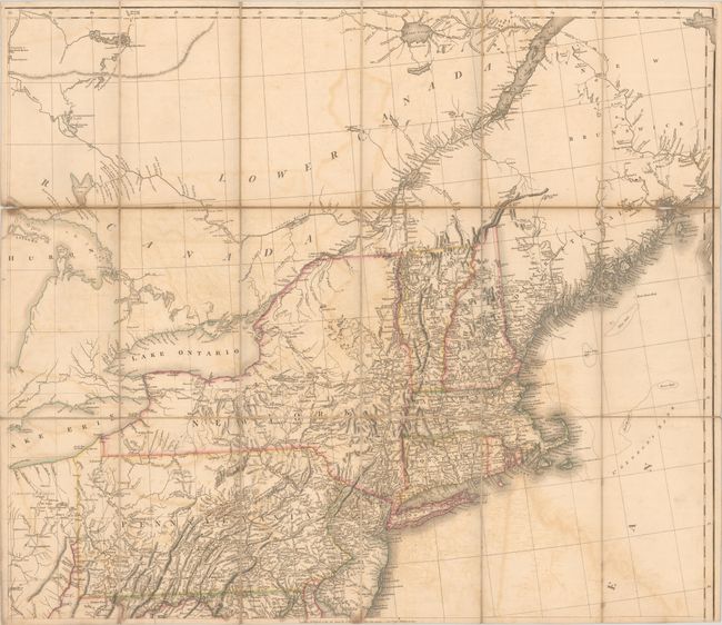
Subject: Eastern United States
Period: 1802 (dated)
Publication:
Color: Hand Color
Size:
27.8 x 24.3 inches
70.6 x 61.7 cm
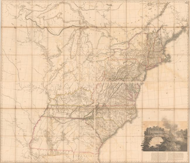
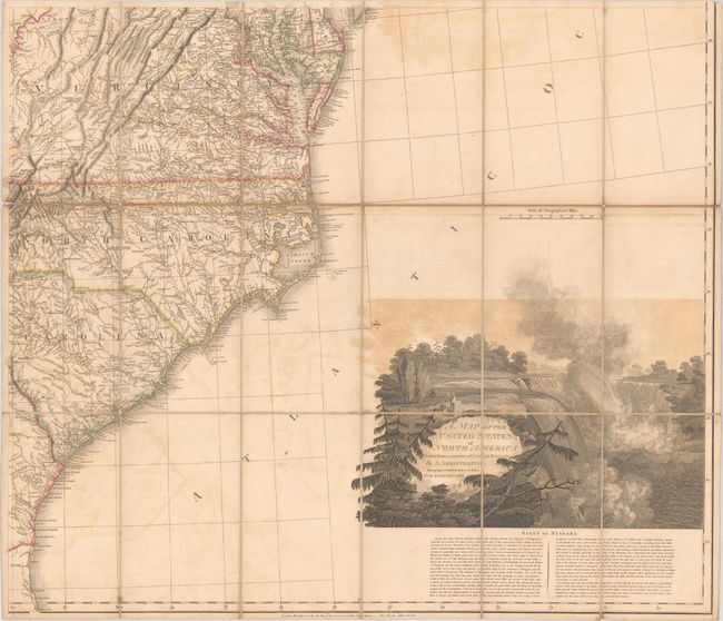
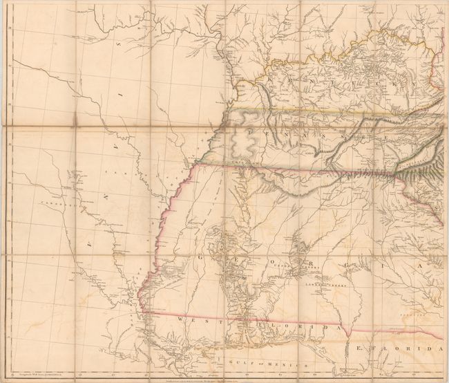
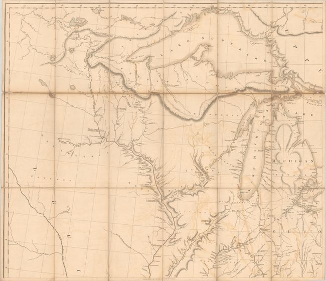
This influential map of the United States was issued on four sheets and measures approximately 56 x 48" if joined. The map has a long history due to its popularity - it was first published in 1796 and went through at least eight other editions through 1819. The 1802 version is notable for being used by Lewis and Clark to plan their famous expedition. This is the fourth revised edition with "additions to 1802" and published in 1808. Stevens & Tree note that many new place names and rivers were added to the plates beginning with this edition.
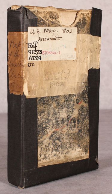
Cartographically, the interior detail of the trans-Mississippi west was compiled largely from accounts supplied by Native Americans to Arrowsmith by the Hudson's Bay Company. The course of the Missouri River delineated on the map prompted Lewis and Clark to plot their course along the Missouri River, as it appeared to be the most direct route to the Pacific. In the south, Florida is divided between East and West, and Georgia's western border is on the Mississippi River. The map is filled with numerous notations describing the land and rivers, the location of Indian tribes, paths, rivers, and more. Decorated by a large engraved view of Niagara Falls inset with the title, along with a fascinating description of the Falls. Published by Aaron Arrowsmith at No. 10 Soho Square in London. Each of the four sheets is dissected and backed with contemporary linen and fits into original marbled paper slipcase with modern cloth tape reinforcing the edges. There is an old Sondley Library, Asheville, North Carolina bookplate on front of slipcase clearly marking "withdrawn." The verso of each dissected sheet has an engraved paper label with the publisher's imprint: "Sold by W. Faden Geographer to His Majesty and to His Royal Highness the Prince of Wales N. 5 Charing Cross."
References: Stevens & Tree #79(e).
Condition: B
Contemporary outline color with light to moderate offsetting and occasional soiling. There are some small holes and tears in the linen, which is a bit fragile. Each sheet has a blindstamp for the Sondley Library in a blank area of the sheet at bottom, and a "withdrawn" stamp appears on the verso of each sheet. Being a former library copy, the slipcase is heavily worn with a few chips and separations along several seams, which have been repaired with cloth tape. Paper labels were also added to the slipcase with library shelving information. The first image is a composite image - the map is in four separate sheets.