Subject: Colonial Northeastern United States & Canada
Period: 1780 (dated)
Publication: Neptune Americo-Septentrional
Color: Black & White
Size:
34.3 x 23.1 inches
87.1 x 58.7 cm
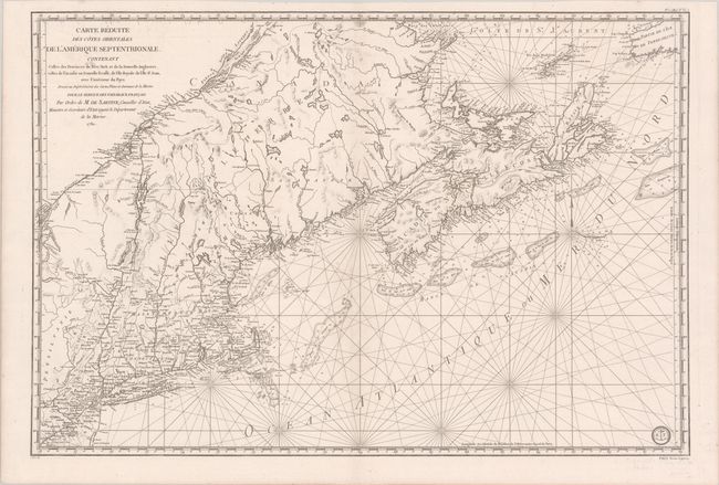
This fine chart was prepared under the direction of Antoine Sartine, Minister of Marine in Paris for use by the French Navy during the American Revolutionary War. It covers the region from Chaleur Bay to New Jersey and includes Prince Edward Island and Cape Breton Island. The chart provides excellent detail of the harbors, bays, inlets, shoals and fishing banks, currents and navigational hazards. In addition to the hydrographical detail it also includes interior information on the towns and forts in New England. The reference in the title to vaisseux du roi has been changed to vaisseux Francaise indicating publication after the French Revolution (circa 1790). The engraved Depot de la Marine stamp appears at bottom right. This is the second state with No. 1 (Hyd. No. 61) in top right margin and Prix Trois Livres in bottom right margin.
References: McCorkle #780.3; Kershaw #754; Sellers & Van Ee #216.
Condition: A
A crisp impression on a clean bright sheet with a couple of minor stains at top right and left.