Subject: Miscellaneous Books
Period: 1795 (published)
Publication:
Color: Black & White
Size:
5.3 x 8.3 inches
13.5 x 21.1 cm
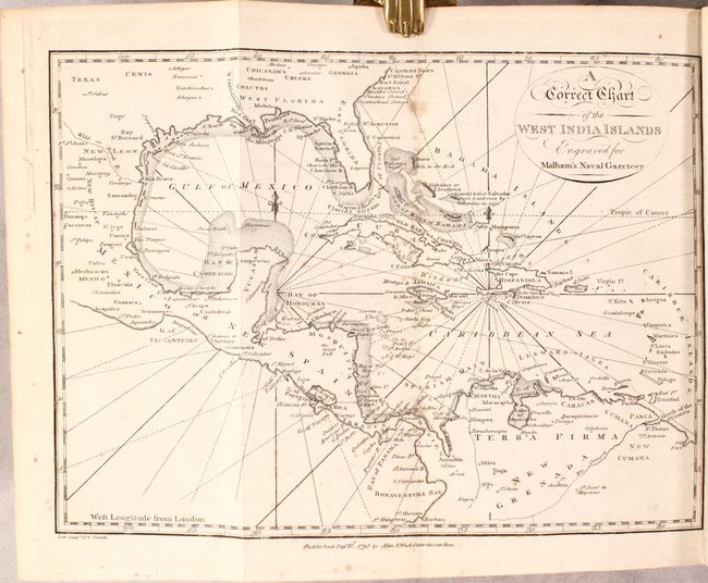
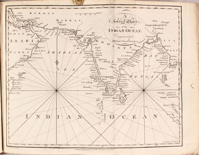
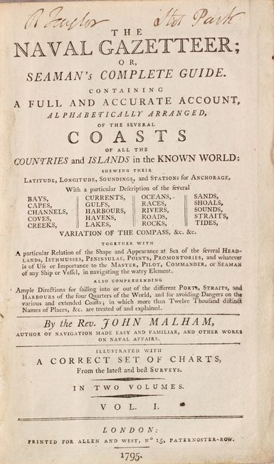
This is the complete first edition of Malham's Naval Gazetteer, containing a total of 17 folding charts of the world, North America, South America, Africa, India, and more based upon recent discoveries and surveys (see image #6 for list of charts). Of particular interest are the following charts:
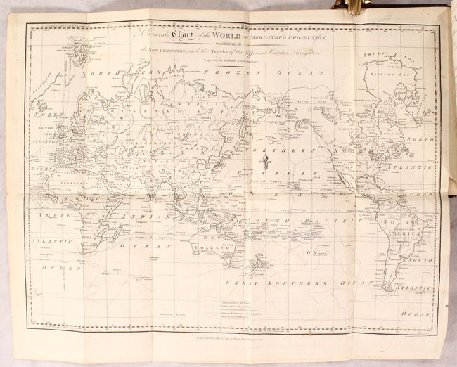
A General Chart of the World on Mercator's Projection (17.8 x 13.3"). This chart of the world outlines the tracks of Captain Cook on his three major voyages of exploration. A key at bottom identifies the tracks of the Endeavour from 1768-71, the Resolution and Adventure from 1772-75, and the Resolution and Discovery from 1776-80. The voyage of the HMS Racehorse and HMS Carcass, commanded by Constantine John Phipps in 1773, is also shown, depicting his attempt at finding a northwest passage from the Atlantic Ocean to the Pacific Ocean. In North America, the northwest coast is not yet fully delineated, and a River of the West is shown extending from Nootka Sound. California is labeled New Albion. Australia is named New Holland with numerous new discoveries by Cook. Diemens Land is still connected to the mainland, as this chart was published just a few years prior to the discovery of Bass Strait by George Bass and Matthew Flinders.
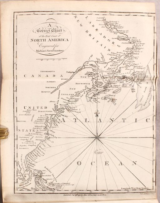
A Correct Chart of the East Coast of North America (7.1 x 9.1"). This handsome chart traces the coast of the young United States north to Canada. Although no borders are shown, a majority of the early states are named, including Vermont and Kentucke, the latest additions to the nation at the time of publication. Numerous towns and major cities, Indian tribes, harbors, sounds, banks, and more are located. The name Indiana appears despite the fact that the map pre-dates the creation of the Indiana Territory in 1800 (likely a reference to the Indiana Company). A note by Salvador or Guanahani (San Salvador) in the Bahamas reads, "First Land seen by Columbus 1492." There is a compass rose capped with fleur-de-lis in the Atlantic that radiates rhumb lines.
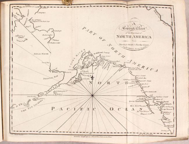
A Correct Chart of the West Coast of North America from Bhering's Straits to Nootka Sound (9.6 x 7.5"). This intriguing chart spans from Queen Charlotte Sound off the coast of British Columbia north to Bering Strait. References are made to the discoveries of Captains Cook, Dixon, and Duncan, but Vancouver's explorations, contemporaneous with the chart's publication, do not appear. The name Alaska appears on the Alaska Peninsula. Much of the coastline north of the peninsula is speculative and terminates in Fields, and Mountains of Ice above Bhering's Straits.
Published in two octavo volumes with a dictionary-style approach. Volume 1 (536 pages) contains 11 charts and volume 2 (548 pages) includes 6 charts. Engraved by Samuel Neele and printed for Allen and West in London. Hardbound in contemporary leather with gilt title labels on the spines.
References: McCorkle (18th Century Geography Books) #251.
Condition: B+
The folding maps are very good with minor soiling and occasional foxing. Text is mostly clean. The hinges are starting on both volumes, covers are moderately worn, and the spines are cracked.