Subject: Exploration and Surveys, Russia & Persia
Period: 1662 (published)
Publication:
Color: Black & White
Size:
7.8 x 11.9 inches
19.8 x 30.2 cm
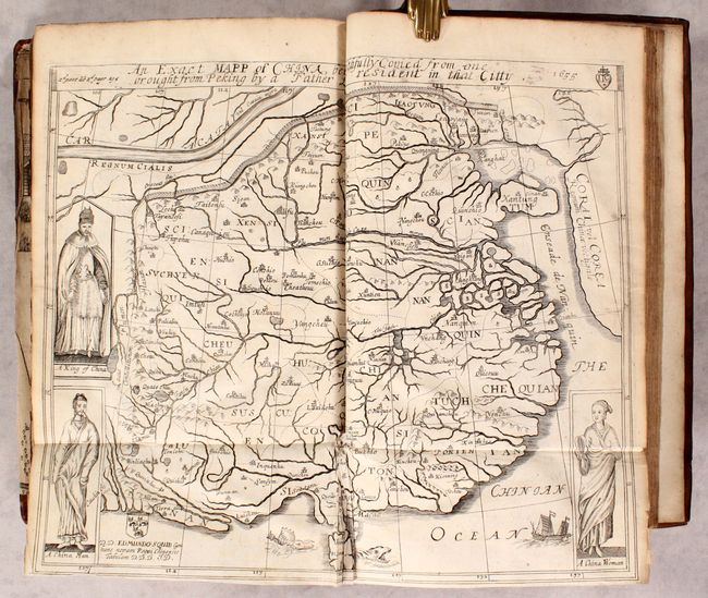
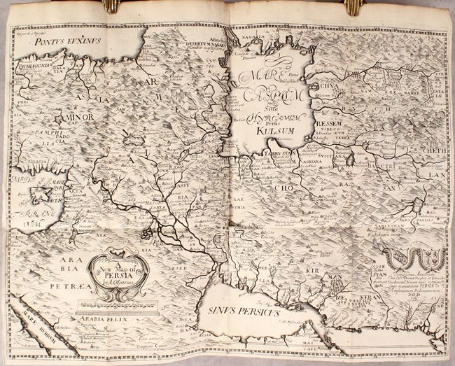
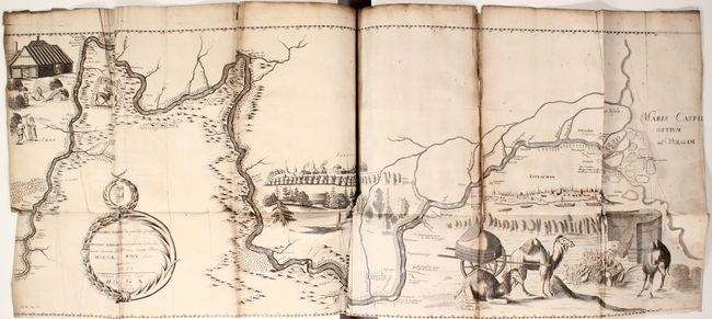
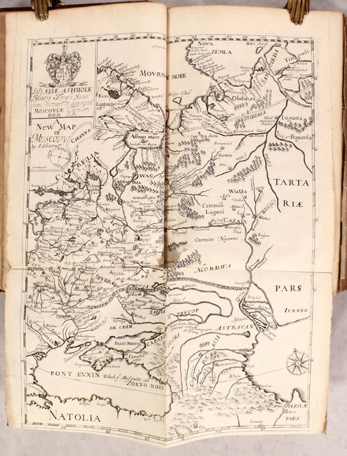
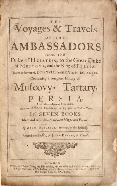
Adam Olearius was sent by Duke Frederick III to Moscow and Persia in 1633 to seek treaties favoring the newly-founded city of Friedrichstadt as the terminus for an overland silk road. He traveled extensively in Russia and Persia and his account of the expedition is one of the most important early accounts of European travels in the region. Although his negotiations with the Shah were not successful, his journey resulted in greatly expanded knowledge of the geography of both empires. Olearius published an account of his travels in German in 1647 with only a few maps. Subsequent editions were published in English, German and French with between 7-40 maps. The English edition was translated by John Davies and includes the following 7 maps:
A. An Exact Mapp of China, Being Faithfully Copied from one Brought from Peking by a Father Lately Resident in that Citty (14.2 x 11.4"). Condition: A dark impression with some misfolds and tiny tears along the centerfold at bottom. (B+)
B. A New Map of Persia (20.5 x 15.1"). Condition: A dark impression with a 1" tear at the central fold intersection. (B+)
C. The Course of the Great River Wolga (41.1 x 15"). Condition: A dark impression with light soiling, offsetting, and a few spots of foxing. There are a number of misfolds, several short fold separations, an 11" fold separation at right, and several 1-2" tears adjacent to the folds. (C)
D. A New Map of Muscovy (12.6 x 15.7"). Condition: A sharp impression with a 2" tear at the fold intersection. (B+)
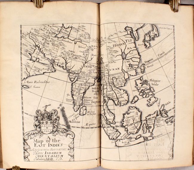
E. A Map of the East Indies (11 x 9.3"). Condition: A dark impression with offsetting and a couple of tiny worm tracks at bottom. (B+)
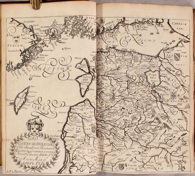
F. A New Map of Liefland (14 x 10.8"). Condition: A nice impression with minor offsetting and a 1" tear at the fold intersection. (B+)
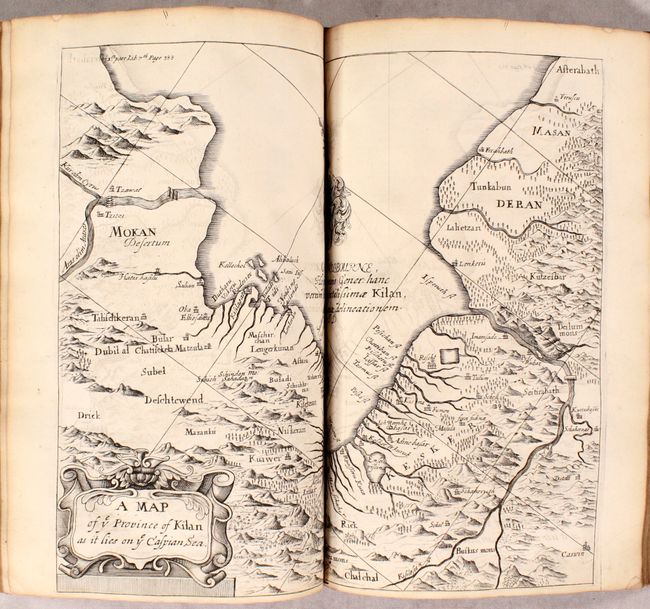
G. A Map of ye Province of Kilan as it Lies on ye Caspian Sea (12.4 x 10.6"). Condition: A dark impression with offsetting and a couple of tiny worm tracks at bottom. (B+)
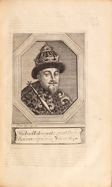
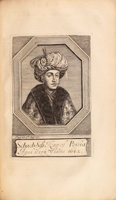
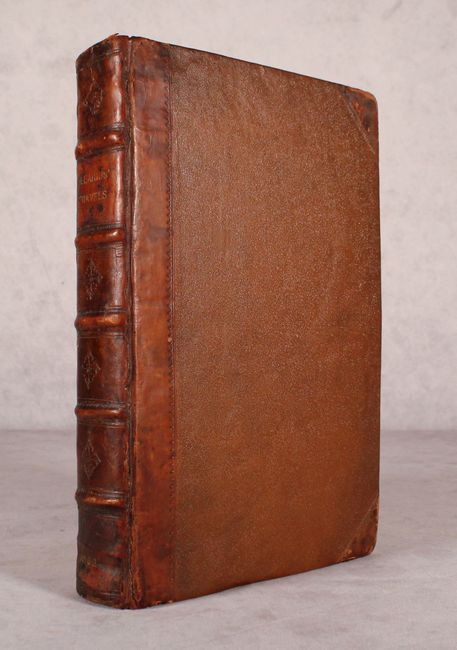
In addition to the maps are three engraved portraits of Duke Frederick, the King of Persia, and the Great Mogol. This example is missing the frontispiece. Quarto; [26], 424, [4], 168, 278, [11] pages. Rebound in quarter brown leather with tips over brown cloth-covered boards; raised bands and embossing on spine with gilt title and date; new endpapers. The book is housed in a modern, archival storage box.
References: Shirley (BL Atlases) G.OLE-1a.
Condition: B+
See above for a detailed description of each map. The text is in very good condition with occasional toning, foxing and soiling. The title page is heavily soiled and a couple of pages have short tears. The volume has been conserved, however the front hinge is starting. The restored covers are in very nice condition with bumped corners and a few small abrasions.