Subject: Colonial North America
Period: 1745 (circa)
Publication: Mr. Tindal's Continuation of Mr. Rapin's History of England
Color: Black & White
Size:
18.5 x 14.8 inches
47 x 37.6 cm
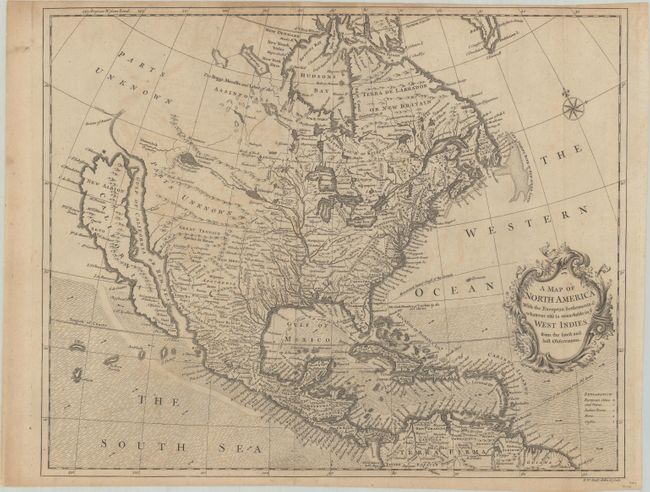
Cartographic myths and much else of interest fill this map of North America. It is one of the last maps to show the island of California although Seale also incorporated some information from Kino in the Southwest. He also continued to portray fanciful details from Baron Lahontan's romantic tale of his 1688-90 travels west of the upper Mississippi River with the Longue River stretching to the Rocky Mountains. The Straits of Annian are noted, but most of the Northwest is marked Parts Unknown and contains little data. Of particular note are the many Indian Towns located throughout the map. Shading designates the trade winds with directional arrows showing the course of the winds. The routes of the Spanish galleons are marked in the Caribbean. An ornate title cartouche and compass rose adorn the map.
References: McLaughlin #228; Shirley (BL Atlases) G.RAP-2a #13; Tooley (Amer) #97; Wheat (TMW) #124.
Condition: B+
Issued folding on watermarked paper with pleasant light toning and minor offsetting.