Subject: Western Africa
Period: 1666 (circa)
Publication: De Zee-Atlas, Ofte Water-Weereld
Color: Hand Color
Size:
21.2 x 17.3 inches
53.8 x 43.9 cm
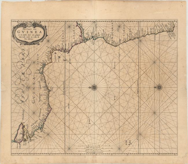
This elegantly engraved sea chart covers the western coast of Africa from present-day Dakar south to the Cape of Good Hope. It features excellent detail along the coastline with numerous place names, tiny islands, and the mouths of larger rivers including the Gambia and Congo. While the interior is essentially blank, the chart does identify the various kingdoms of the region including Benin, Gabon, and Mandinga to name a few. North is oriented to the left. Decorated by a strapwork title cartouche, three distance scales, two compass roses, and rhumb lines in the waters. Pieter Goos' marine charts were highly esteemed in the seventeenth century and the Zee-Atlas was often published with Blaeu's Atlas Maior, the most lavish and expensive cartographic publication of the period.
References:
Condition: B+
There is light scattered foxing and archivally repaired edge tears in the left and right blank margins, with the left tear just entering the map image. A few place names are underlined in manuscript.