Catalog Archive
Auction 180, Lot 696

"Partie de la Nouvelle Grande Carte des Indes Orientales, Contenant les Terres du Mogol, Surate, Malabar, Cormandel, Bengale, Aracan, Pegu, Siam, Camboje, Tonquin, & une Partie de la Chine...", Elwe, Jan Barend

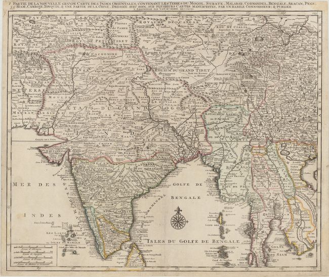
Subject: Southern & Eastern Asia

Period: 1792 (dated)

Publication:

Color: Hand Color

Size:
23.8 x 19.8 inches
60.5 x 50.3 cm
Download High Resolution Image
(or just click on image to launch the Zoom viewer)

This is the northwest sheet of a four-sheet map of Southern and Southeast Asia, with each map containing its own title and stand-alone borders. This map is focused on the Bay of Bengal and details the region from the Pakistani border across India to the Indo-Chinese peninsula with Burma, Cambodia, Vietnam and Laos, showing quite a bit of China and the northern half of Sri Lanka. The Bengal Gulf is adorned with a large compass rose. The map is filled with meticulous topography and place names.

References:

Condition: B+

Contemporary outline color on watermarked paper with professional repairs to a few short centerfold separations. Minor soiling mostly along the sheet edges.

Estimate: $300 - $375

Unsold

Closed on 11/18/2020

Archived