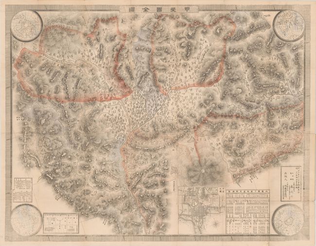
Subject: Yamanashi-ken, Japan
Period: 1879 (circa)
Publication:
Color: Hand Color
Size:
33.9 x 26.5 inches
86.1 x 67.3 cm
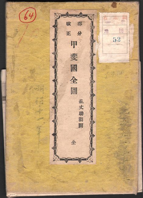
This map by Josuke Mori shows the historical Kai province that is now known as the Yamanashi Prefecture. The map is oriented with north to the upper left and gives great detail of topography shown by hachures, including the impressive Mount Fuji. Also depicted are cities, roads, and rivers in the region. The corners of the sheet feature four hemisphere maps of the North Pole, the Eastern Hemisphere, the Western Hemisphere, and the South Pole. An additional inset includes a bird's-eye plan of Kofu. Issued folding into attached paper wrappers with a printed title label.
References: Rumsey #D158.
Condition: B+
Contemporary color with a few short fold separations and a minor worm track. Several of the fold separations have been archivally repaired on verso.