Subject: Persia - Iran
Period: 1780-85 (circa)
Publication:
Color: Black & White
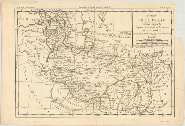
A. Carte de la Perse, Redigee en Partie d'Apres le Voyage et les Cartes de M. Niebuhr, by Louis Brion de la Tour, from Histoire Universelle, circa 1780, (13.6 x 9.3"). This detailed map covers the region stretching from the Caucasus through Persia and Afghanistan to the Indus River. It is based on Carsten Niebuhr's travels with the Danish Arabia expedition (1761-67). Condition: A crisp impression on watermarked paper with some minor toning in the blank margins and a binding trim in the right blank margin. (A)
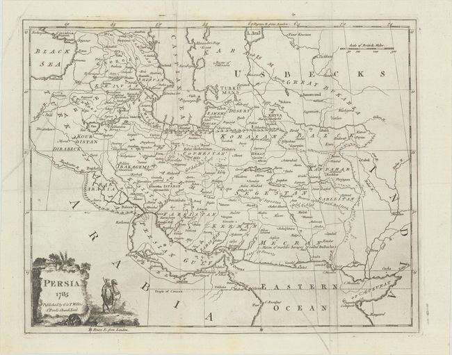
B. Persia, by G. & T. Wilkie, from A New System of Geography..., dated 1785, (13.1 x 10.4"). This handsome map centers on Persia and stretches from the Euphrates to the Indus River. It locates towns and cities, deserts, ruins, and travel routes. A note in Mecran (Makran) warns of "a Nation of warlike Savages called Balluches." The decorative title cartouche at bottom left features a figure with a sword riding on a camel. Reference: McCorkle (18th C. Geography Books) #110-5. References: Issued folding with a few printer's creases, some extraneous creasing, faint scattered foxing, and light soiling. (B+)
References:
Condition:
See description above.