Subject: Holy Land
Period: 1833 (dated)
Publication:
Color: Hand Color
Size:
36 x 68 inches
91.4 x 172.7 cm
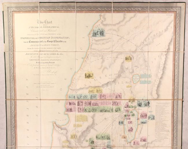
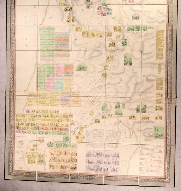
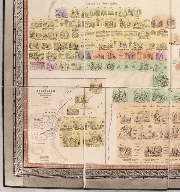
This large, uncommon, and information-packed map of the Holy Land by R. Mimpriss stretches from Abilene to the Dead Sea. It seeks to provide a comprehensive overview of every location mentioned in the Gospels. An extensive key identifies the locations of 337 events from the Bible. The routes of numerous journeys through the region are delineated with scriptural notations. The map is illustrated with dozens of Biblical vignettes, including sections showing various events in Jerusalem, during the Crucifixion, and after the Resurrection. Additionally, it includes a chronology of Gospel history, a general summary of the Gospels, and a table crediting the geographers who have located places mentioned in the Bible. An inset plan of Jerusalem appears at bottom left. The map is surrounded by a lovely decorative border. Published by Sampson Low. Dissected and mounted on original linen with green ribbon edging. It slides into a green cloth slipcase with gilt title and decorations on the front cover.
References:
Condition: B+
There are faint stains, a couple horizontal strips of light toning, and minor offsetting. The slipcase is lightly soiled and worn around the edges.