Catalog Archive
Auction 180, Lot 530

"S.R.I. Principat. et Archiepiscopatus Salisburgensis Mappa Geographica Delineatus", Seutter/Lotter

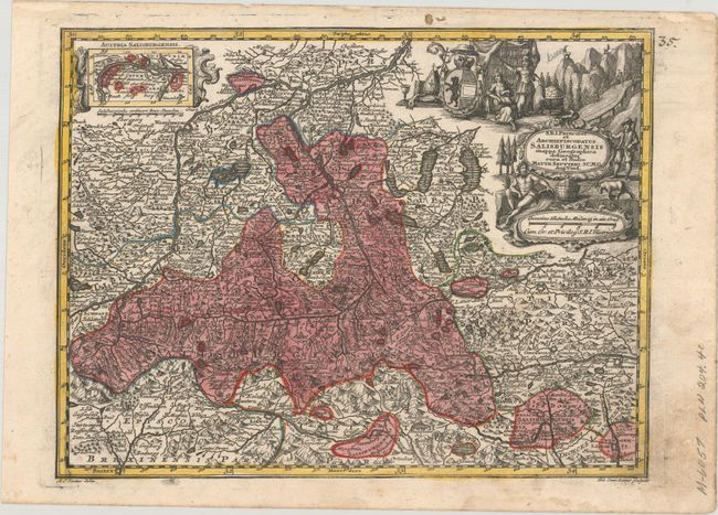
Subject: Western Austria

Period: 1744 (circa)

Publication: Atlas Minor

Color: Hand Color

Size:
10.2 x 7.7 inches
25.9 x 19.6 cm
Download High Resolution Image
(or just click on image to launch the Zoom viewer)

This small and boldly engraved map is centered roughly on Salzburg. It features the region's mountains, rivers, roads, villages, towns and fortifications. A small inset shows the vicinity of Krems and the Danube River. A decorative allegorical cartouche fills the upper right corner featuring a river god, a hunter and mountain goats. The map is a very fine example of the ebullient engraving style that was popular with German cartographers in the early eighteenth century.

References: Shirley (BL Atlases) T.SEU-3a #34.

Condition: A

A dark impression with contemporary color and marginal soiling.

Estimate: $70 - $90

Sold for: $50

Closed on 11/18/2020

Archived