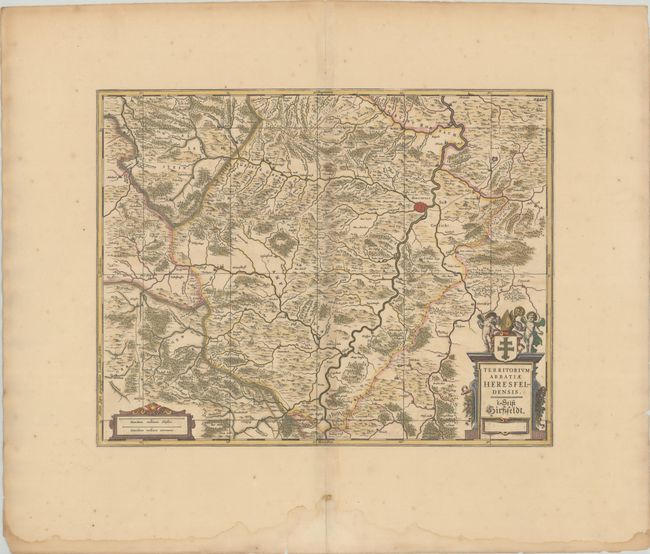
Subject: Central Germany
Period: 1680 (circa)
Publication: The English Atlas
Color: Hand Color
Size:
19.3 x 15.1 inches
49 x 38.4 cm
This handsome map shows the vicinity of Bad Hersfeld and the Fulda River in the Prussian province of Hesse-Nassau. It is fully engraved with topographical information and decorated with scale and title cartouches adorned with putti and a coat of arms. The plate was originally engraved by Jan Jansson. After his death it was inherited by his son-in-law, known as Jansson-Waesberg, who published it in conjunction with Moses Pitt. This map was published in Volume III of Pitt's The English Atlas, which was initially planned as 12 volumes, but only four volumes were published before Pitt abandoned the project due to debt. This edition adds a graticule and features no imprint. Blank verso.
References: Van der Krogt (Vol. I) #2463:1B.2.
Condition: B+
On a watermarked sheet with contemporary color and faint toning along the centerfold. In the blank margins, there are centerfold separations at top and bottom and a large dampstain at bottom.