Subject: Central Europe, Germany
Period: 1584 (published)
Publication: Theatrum Orbis Terrarum
Color: Hand Color
Size:
19.8 x 14.3 inches
50.3 x 36.3 cm
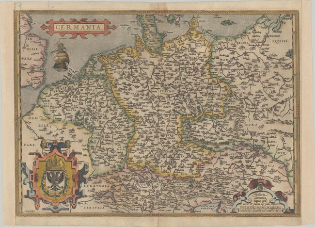
Elegant map of the German Empire, which at the time included the Netherlands and Belgium, stretching from Calais to the Wista River in present day Poland, and south to the Adriatic Sea. Ortelius based this beautiful map on Christiaan Sgrothen's map of 1565. The title is enclosed is a strapwork cartouche, below which sails a large ship, and two large cartouches incorporate the royal coat of arms and scale of miles. Latin text on verso.
References: Van den Broecke #56.
Condition: B+
On watermarked paper with minor toning along the centerfold at top, an extraneous vertical crease at left, and centerfold separations at top and bottom that have been closed with archival materials on verso. Remargined at sides with a bit of neatline in facsimile at top left.