Subject: Central Belgium
Period: 1645 (circa)
Publication: Nieuwen Atlas...
Color: Hand Color
Size:
20.7 x 16.4 inches
52.6 x 41.7 cm
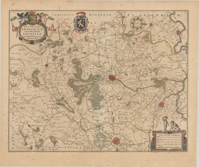
This handsome map of the region centers on Brussels. It was drawn by Michael Floris van Langren, the mathematician and astronomer to the King of Spain. The map is oriented with north to the right and includes the cities of Mechelen, Leuven and Ninove, as well as the surrounding forests, villages, roads, and canals. It is nicely decorated with title cartouche, coat of arms, scale of miles, compass rose, and four pudgy cherubs. Dutch text on verso, published between 1645-58.
References: Van der Krogt (Vol. I) #3111:1.2.
Condition: B+
A crisp impression with full contemporary color. There is light scattered foxing, minor toning, and some color offsetting. A centerfold separation in the bottom blank margin has been closed on verso with old paper.