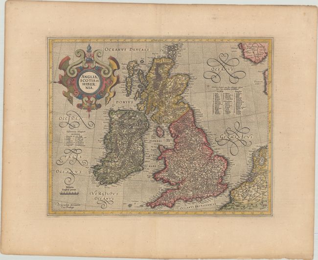
Subject: Britain
Period: 1619 (published)
Publication: Gerardi Mercatoris - Atlas sive Cosmographicae
Color: Hand Color
Size:
16.3 x 13 inches
41.4 x 33 cm
This superb map of the British Isles was likely one of the last works of this great cartographer. It was first published a year after Gerard Mercator's death. The map provides a very detailed view of the region with counties named in tables. Mercator's shape for Scotland became the standard for more than 50 years. Decorated by a bold strapwork title cartouche and stippled sea. French text on verso.
References: Moorland & Banister p. 209; Shirley (BI to 1650) #180; Van der Krogt (Vol. I) #5000:1A.
Condition: B+
A crisp impression on paper with a small coat of arms watermark, light toning, and minor foxing. There is an archivally repaired centerfold separation in the bottom blank margin.