Catalog Archive
Auction 180, Lot 393

"Carte Generale de l'Europe ou sont Tracees les Principales Routes en les Nouvelles Divisiones de Cette Premiere Partie du Monde...", Herisson, Eustache
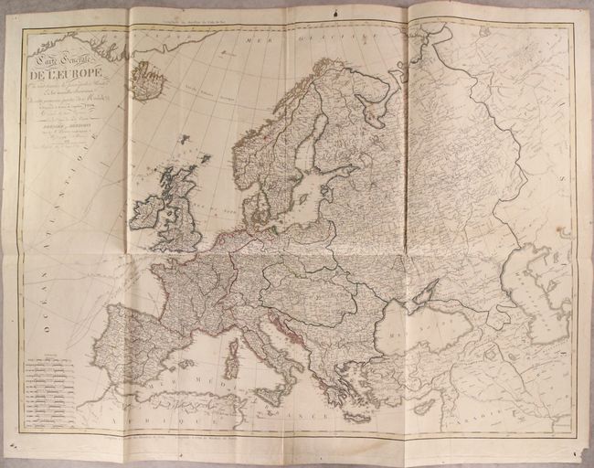
Subject: Europe

Period: 1811 (dated)

Publication:

Color: Hand Color

Size:
47 x 34.3 inches
119.4 x 87.1 cm
Download High Resolution Image
(or just click on image to launch the Zoom viewer)

This large-scale map extends from Iceland and Spain east to the Ural Mountains and Caspian Sea. The most prominent feature of the map are the tracks of Captain Cook's voyages from Britain to points west. It is densely filled with detail including the latest political boundaries, numerous place names, rivers, mountains, and more. Includes a staggering 14 different distance scales at bottom left. Printed on four joined sheets.

References:

Condition: B+

Issued folding with light scattered foxing and some minor extraneous creasing. There are a few holes and edge chips confined to the blank margins.

Estimate: $275 - $350

Sold for: $200

Closed on 11/18/2020

Archived