Subject: Chile
Period: 1636 (published)
Publication: Atlas or a Geographicke Description of the Regions, Countries and Kingdoms of the World...
Color: Hand Color
Size:
19 x 14.7 inches
48.3 x 37.3 cm
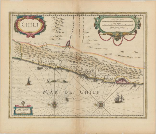
Striking map covering the known coastal region of Chile from approximately Antofagasta in the north to Cabo Gallegos in the south. The Andes are shown prominently, with two live volcanoes in the vicinity of Villarrica. Beyond the mountains, in what is now Argentina, is a large unnamed (and non existent) lake with the cities of Mendoza and San Juan - with San Juan incorrectly placed to the south of Mendoza. Otherwise, the map is surprisingly accurate for its age with many recognizable place names: La Serena, S. Iago (Santiago), Concepcion, Valdivia and the Gulf of Ancud are all located. Decorated with two large cartouches, two compass roses, ships and sea monsters. English text on verso.
References: Van der Krogt (Vol. I) #9920:1.1.
Condition: B+
Nice impression in contemporary color on paper with a large "V" watermark, light toning along the centerfold, and light text show-through. The top blank margin has remnants of hinge tape. There is a tiny separation at bottom centerfold and a few tiny tears along the edges of the sheet that are well away from the image.