Subject: Caribbean
Period: 1782 (dated)
Publication:
Color: Hand Color
Size:
28.2 x 19.8 inches
71.6 x 50.3 cm
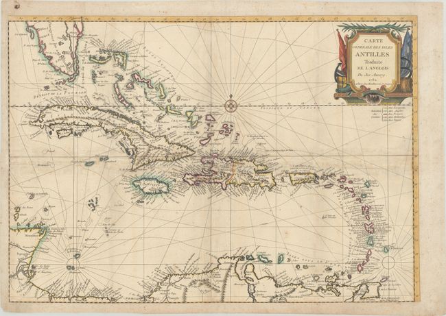
A handsome and detailed chart of the Caribbean extending from southern Florida and the Bahamas to the Lesser Antilles and the northern coast of South America. South Florida is depicted here as a solid landmass as opposed to an archipelago, which was common at this time. It includes excellent coastal detail, numerous place names, and the mountainous topography of the larger islands. A key at right identifies the colonial possessions of the Spanish, English, French, Dutch, and Danish. Decorated by a strapwork title cartouche, rhumb lines, and compass rose with fleur-de-lis. Based upon the hydrography of Joseph Avery. A scarce map with only one institutional example located (John Carter Brown Library).
References:
Condition: B
Issued folding on watermarked paper with some light toning and minor foxing. All of the folds have been reinforced on verso with old paper to repair a few small separations, and the map has been remargined on all sides.