Subject: Yorktown, Virginia
Period: 1787 (published)
Publication: Histoire des Troubles de l'Amerique Anglaise...
Color: Hand Color
Size:
14.9 x 11.3 inches
37.8 x 28.7 cm
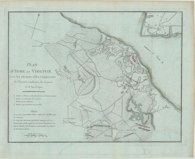
This uncommon and unusual Revolutionary War period map of the battle of Yorktown was one of three issued in Francois Soules' Histoire des Troubles de l'Amerique Anglaise. The Battle of Yorktown decided the course of the war and the future of the United States. The map shows the positions of British, American and French troops and fortifications at Yorktown and Gloucester. There is good detail of the roads, watershed, and topographical information. The French and American positions are named, and the headquarters of General Washington and Rochambeau are noted. A simple compass rose orients north to the top right.
References: Nebenzahl (Biblio) #198; Howes #S770.
Condition: A
Issued folding now flattened, on bluish paper with a bunch of grapes watermark and contemporary color. There is a hint of offsetting and light toning along the edges of the sheet.