Subject: San Antonio, Texas
Period: 1935-41 (circa)
Publication:
Color: Black & White
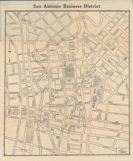
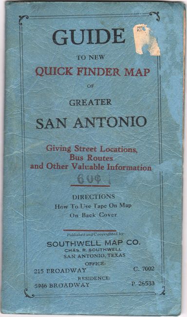
A. San Antonio Business District [in] Guide to the New Quick Finder Map of Greater San Antonio Giving Street Locations, Bus Routes and Other Valuable Information, by Southwell Map Co., dated 1935 (13.4 x 15.3"). Shows the street grid pattern of downtown with numerous buildings and points of interest identified including the Alamo, Travis Park, City Hall, and more. The verso features a "Tourist Map of San Antonio." The accompanying 32 pages of text includes extensive detail on schools, streets, subdivisions, bus lines, and more. Folds into blue paper wrappers (4.5 x 7.8"). No past sales records or institutional examples located on OCLC. Condition: The map is clean and bright with minor loss along the upper fold. Paper wrappers are lightly worn and stained. (B+)
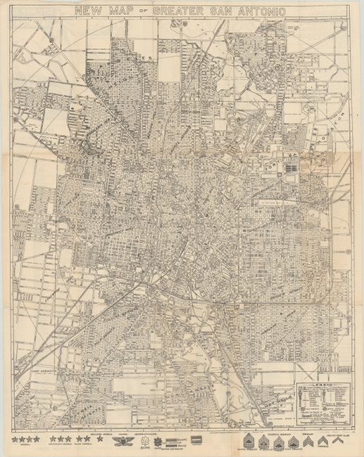
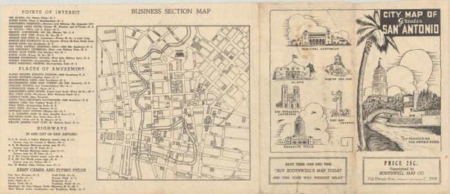
B. New Map of Greater San Antonio, by Southwell Map Co., circa 1941 (18.1 x 22.5"). A very detailed map identifying both public and Catholic schools, neighborhoods, and many places of interest, particularly related to the military. Verso contains an index and business section map. Circa date is inferred from text indicating the new airport was under construction, which was put into service in 1942. With an interesting “Buy War Bonds Today” appeal to preserve “Liberty and Christianity" on verso. Condition: On a bright sheet with a few small fold separations. (A)
References:
Condition:
See description above.