Subject: Northern New Mexico & Southern Colorado
Period: 1897 (published)
Publication:
Color: Black & White
Size:
16.6 x 8.7 inches
42.2 x 22.1 cm
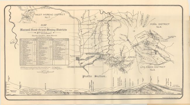
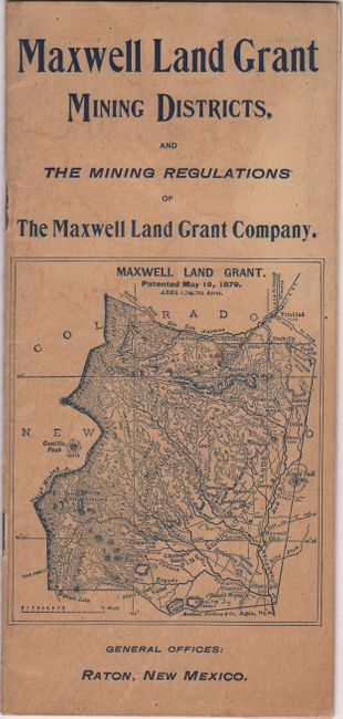
This promotional brochure was published by the Maxwell Land Grant Company and was used to market their newly acquired lands to gold prospectors. Originally a holdover from when the area was under Mexican control, the Maxwell Land Grant was a source of contention between the title holder and squatters until the Supreme Court in 1894 ruled in favor of the company's title. With the court's ruling the squatters disbanded and the company began selling mining interests. Accompanying the 16 pages of descriptive text is a folding map identifying 5 different mining districts along with a detailed table of the mining claims that are keyed to the map. Also located on the map are the large Placer Grounds east of Elizabethtown, the Aztec gold mine, and the Ponil Copper Company. Folds into beige paper wrappers (4.0 x 8.7"). Only 2 institutional examples are located on OCLC (Yale and the Huntington Library).
References:
Condition: B+
The folding map is clean and bright with a 1.5" edge tear at top right that has been closed on verso with archival tape. Paper wrappers have light soiling and staining.