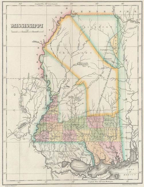
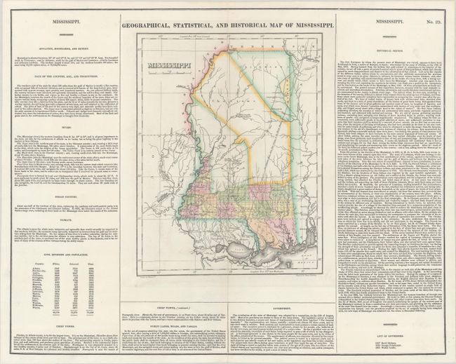
Subject: Mississippi
Period: 1822 (circa)
Publication: A Complete Historical, Chronological, and Geographical American Atlas...
Color: Hand Color
Size:
8.9 x 11.5 inches
22.6 x 29.2 cm
This map is on a full folio sheet (21.5 x 17.6") surrounded by English text giving a brief description of the state’s boundaries, rivers, climate, chief towns, government, and history. The finely engraved map delineates rivers, roads, counties and major towns. Development is confined to the southern portion of the state, with the large Choctaw and Chickasaw lands occupying the upper two-thirds of the state. Identifies "General Jackson’s Road from New Orleans to the Muscle Shoals" and Baron Bastrop's Claim in neighboring Louisiana. Drawn by Fielding Lucas, Jr. and engraved by Young & Delleker.
References: Phillips (Maps) p. 435.
Condition: A
Contemporary color on a bright sheet, professionally backed in thin, archival tissue.