Subject: Washington, D.C.
Period: 1879-80 (circa)
Publication:
Color: Printed Color
Size:
21.2 x 16.2 inches
53.8 x 41.1 cm
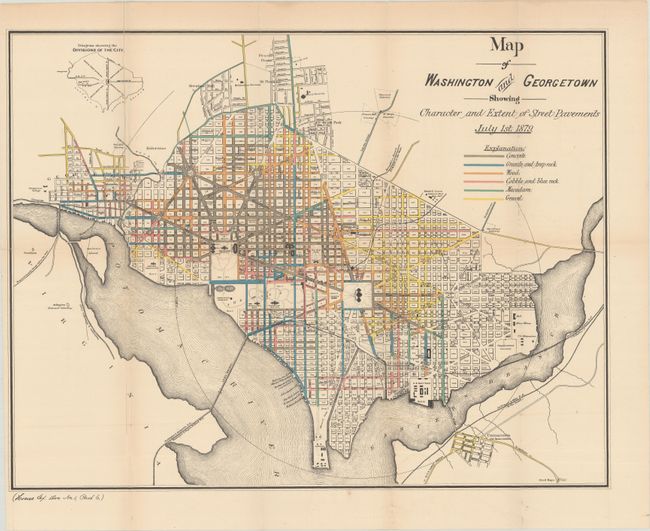
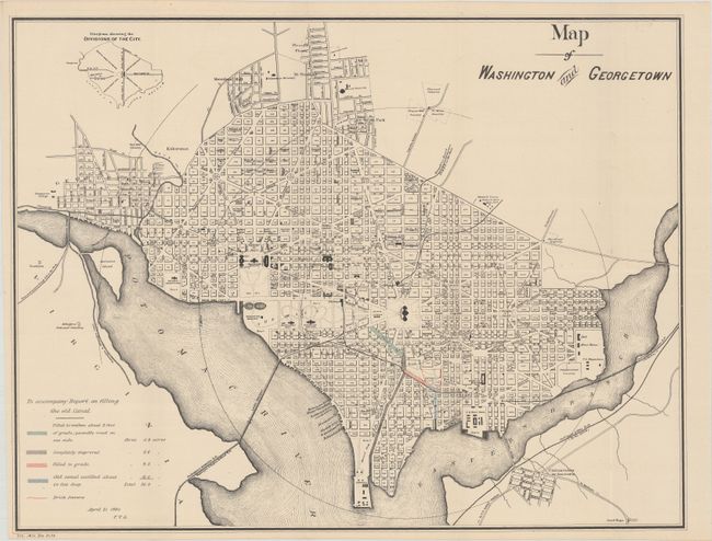
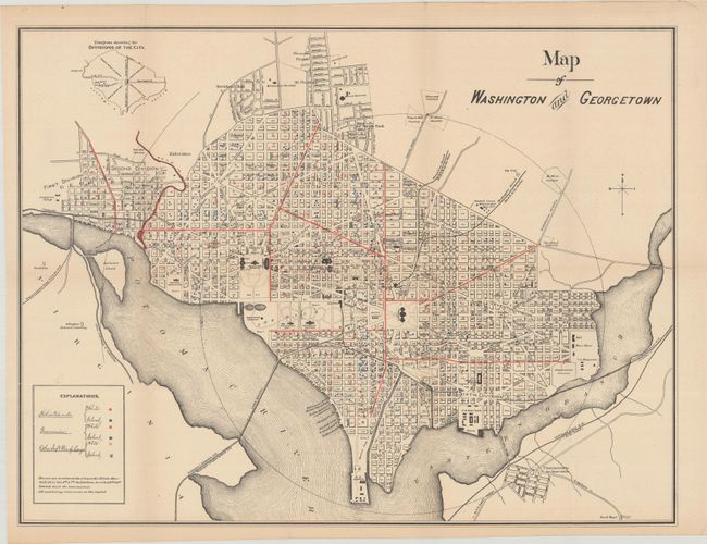
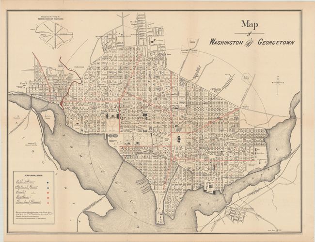
This historical set of maps was issued during a time of tremendous growth for the nation's capital. The large increase in residents strained the city's resources, and the need arose to improve both the city's aging infrastructure as well as the health of its citizens as a result of the living conditions. The first two maps address infrastructure and show the types of roads (gravel, wood, concrete, etc.) in the city as well as the status of infilling an old canal between Maryland Avenue and the Potomac River. The last two maps showing the occurrence of various diseases and afflictions including Typhoid Fever, Malarial Fever, Scarlet Fever, and lung afflictions.
References:
Condition: B+
The maps are very good to near fine with a hint of toning. The first map has a couple of long fold separations and a short edge tear at left that have been closed on verso with archival tape.