Subject: Los Angeles, California
Period: 1929-45 (circa)
Publication:
Color: Printed Color
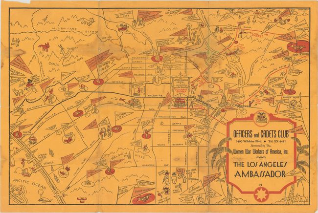
A. Officers and Cadets Club … Sponsored By The War Workers Of America, Inc. The Los Angeles Ambassador, by Jud Wright, circa 1943 (15.5 x 10.2"). This pictorial map presents Los Angeles in a fun, whimsical manner despite being issued during World War II. The map emphasizes the lighter side of life, emphasizing entertainment opportunities in the region including the Santa Anita Races, Gay's Lion Farm, Grauman's Chinese Theater, and Beverly Hills (Homes of Worlds Greatest Movie Stars). The Ambassador Hotel is prominently depicted at center and a host of characters fill the surrounding area. Jud Wright was a staff artist for the Los Angeles Times. There are no past sales records or institutional examples located on OCLC. Condition: Issued folding with light damp stains along the folds and a few tiny splits at the fold junctions. (B)
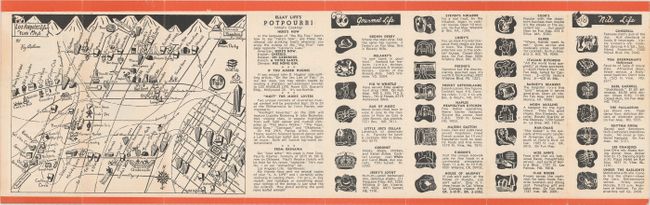
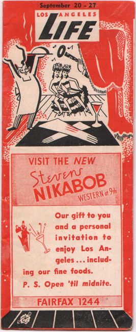
B. Los Angeles Life Fun Map, by Kay Antrim, published 1945 (6.8 x 5.1"). This scarce little promotional map highlights restaurants, clubs, theaters, movies, and more. Folds into a lively 8 panel issue of Los Angeles Life, September 20-27 with numerous business listings that appear on the map. Under the "Star Life" section, it is noted that "Ronald Reagan and Robert Sterling are once again civilians and will soon report back to their studios.” There are no past sales records or institutional examples located on OCLC. Condition: A clean example, issued folding. (A)
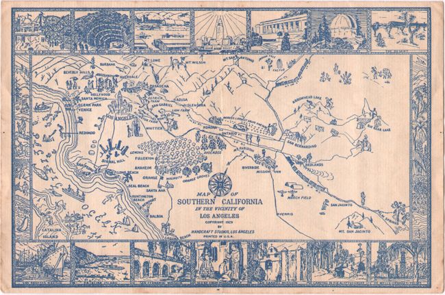
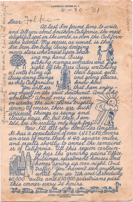
C. Map of Southern California in the Vicinity of Los Angeles, by Handcraft Studios, dated 1929 (8.9 x 6.0"). This small pictorial map was printed in blue ink and extends from Big Bear Lake and Palm Springs to the Pacific Ocean. The map is surrounded by small vignettes including Los Angeles Harbor, Catalina Island, Mt. Wilson Observatory, and more. The map is the last page of a 4 page illustrated “letter” promoting Southern California (page 1 is the verso of the map). Accompanied by its (used) mailing envelope. There are no past sales records or institutional examples located on OCLC. Condition: A mostly clean example with some manuscript notations and foxing on verso. (B+)
References:
Condition:
See description above.