Subject: Los Angeles, California
Period: 1915 (dated)
Publication:
Color: Printed Color
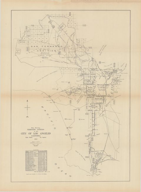
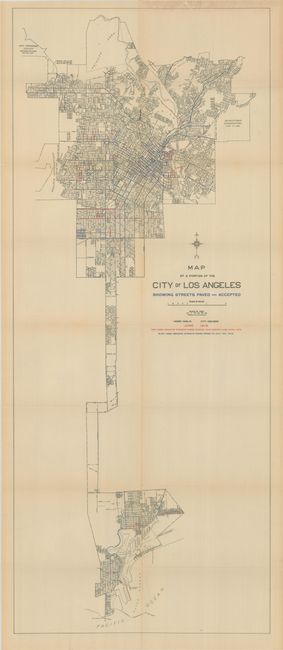
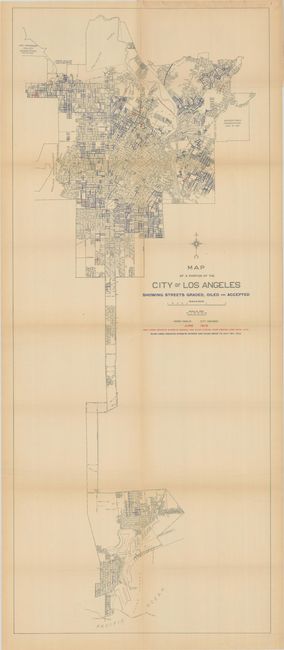
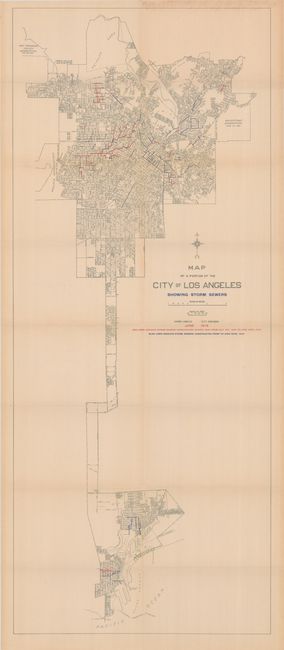
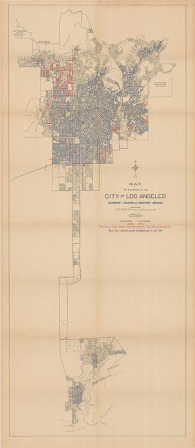
These five maps present the city of Los Angeles and its evolving infrastructure in 1915 as it attempted to deal with a population explosion, having grown from 100,000 in 1900 to 439,000 in 1914. The first map demonstrates how the city's footprint grew through a series of annexations from 1869-1915, with the Palms Addition, San Fernando Addition, and Bairdstown Addition all occurring in 1915. The remaining four maps utilize the same base map with color overprinting revealing the status of roads, storm drains, and sewers. Drawn by Homer Hamlin, City Engineer. No past sales records or institutional holdings found on OCLC for this 1915 edition, though we have sold editions from 1914 and 1917.
A. Map Showing Territory Annexed to the City of Los Angeles California, black & white (12.5 x 17.9").
B. Map of a Portion of the City of Los Angeles Showing Streets Paved and Accepted, printed color (15.6 x 37.6").
C. Map of a Portion of the City of Los Angeles Showing Streets Graded, Oiled and Accepted, printed color (15.6 x 37.6").
D. Map of a Portion of the City of Los Angeles Showing Storm Sewers, printed color (15.6 x 37.6").
E. Map of a Portion of the City of Los Angeles Showing Locations of Sanitary Sewers, printed color (15.6 x 37.6").
References:
Condition: B+
Issued folding with pleasant light toning and some small splits at the fold junctions.