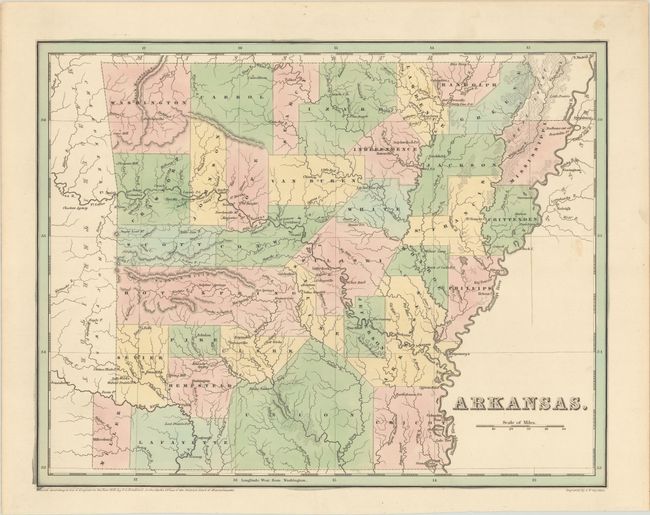
Subject: Arkansas
Period: 1838 (dated)
Publication: An Illustrated Atlas, Geographical, Statistical, and Historical, of the United States…
Color: Hand Color
Size:
14.4 x 11.3 inches
36.6 x 28.7 cm
This copper engraved map by G.W. Boynton appeared two years after Arkansas became a state and is one of the earliest published maps of the state. Of particular interest are the counties of Miller and Lafayette in the southwest corner of the state. This region was in dispute with the then Republic of Texas. All of Miller County, as shown on this map, was ceded to Texas when it became a state in 1845. The map shows good topographical, geographical, and political detail, but no roads, trails, or railways. Not to be confused with the more common maps from Bradford’s Comprehensive Atlas, this map is several inches larger and carries much more information.
References:
Condition: A
Contemporary color with a bit of minor soiling at right.