Subject: Western United States
Period: 1948 (dated)
Publication:
Color: Printed Color
Size:
24.3 x 16 inches
61.7 x 40.6 cm
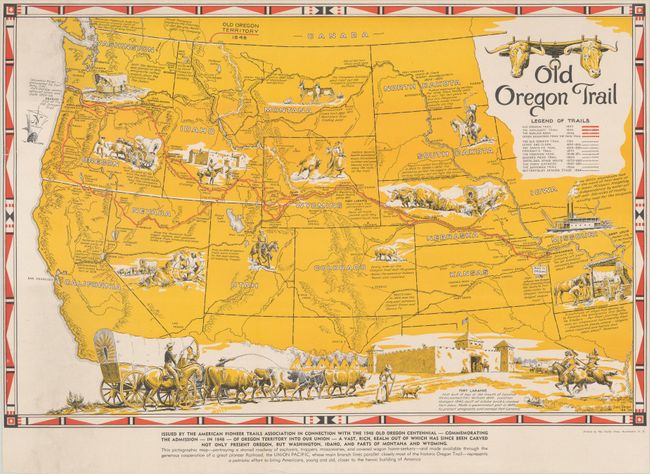
This map highlights the Oregon Trail from Independence, Missouri to the mouth of the Columbia River in Oregon and outlines the numerous routes used by "explorers, trappers, missionaries, and covered wagon home-seekers" to travel west. The map was created in celebration of the centennial of the admission of Oregon Territory to the United States, and was published with the assistance of the Union Pacific Railroad. Notes with facts and historical events are included throughout the map, and images of settlers, Native American Indians, covered wagons, and a steamboat fill the empty spaces. A lovely vignette of Fort Laramie in Wyoming extends across the bottom of the map. Created by Irvin Shope and printed by the Clarke Press in Manchester, New Hampshire. Irving "Shorty" Shope (1900-1977) was a native of Montana and one of the charter members of the Cowboy Artists of America
References:
Condition: A
Bold color on a bright sheet with minor soiling at bottom left. The sheet has been backed in linen to repair a short edge tear at left. The left, top and right margins are narrow.