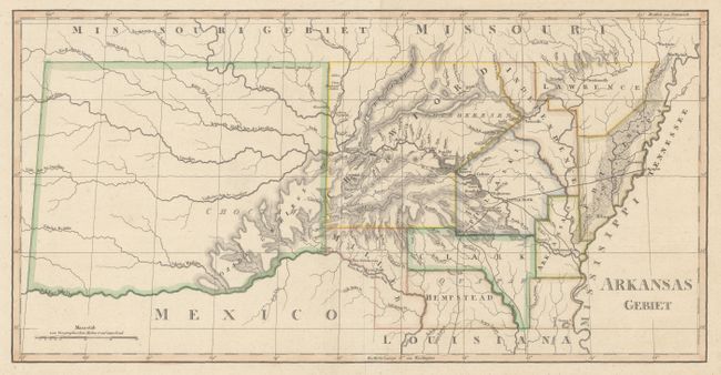
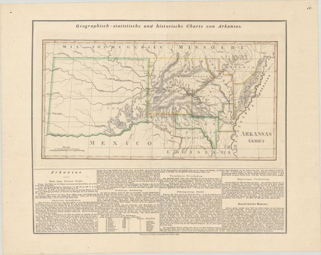
Subject: Arkansas Territory
Period: 1828 (published)
Publication: Atlas von Amerika
Color: Hand Color
Size:
18 x 9.2 inches
45.7 x 23.4 cm
Carey & Lea's 1822 American Atlas was such a commercial success that in addition to the Philadelphia and London editions, there was a French edition by Buchon in 1825 and a German edition by Weiland in 1828. The German edition is by far the rarest. The maps were engraved by the Weimar Geographischen Insitut and the quality is superb.
While Carey & Lea’s map featuring Arkansas covered the lands of the Louisiana Purchase, Weiland’s map concentrates just on Arkansas Territory. It shows the territory just prior to the creation of the Arkansas-Indian Territory border in 1828. Early county configurations include an unnamed Chicot County and the initial Miller County, a portion of which was ceded to Texas when Arkansas became a state. The massive Indian region to the west is devoid of any settlement information. German text below the map describes the territory. The map is virtually unknown on the market. Measures 19.4 x 16.4” with text.
References:
Condition: A
Contemporary outline color on a sheet with wide margins.