Subject: Western Africa
Period: 1759-60 (circa)
Publication:
Color:
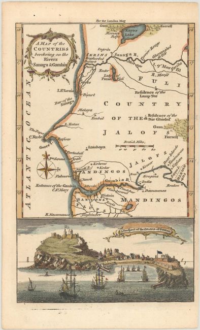
A. A Map of the Countries Bordering on the Rivers Sanaga & Gambia, from London Magazine, published 1759, hand color (4.6 x 7.1"). This handsome small map focuses on the stretch of coast between the Senegal and Gambia rivers. It shows place names, rivers, lakes, and gum forests. Saint-Louis, capital of the Senegal colony, is located, as is the island of Goree. A view of Goree appears below the map. The map was published in February 1759, during the Seven Years War and not long after the British had captured Goree and Senegal from the French. Reference: Jolly #LOND-159. Condition: A nice impression on watermarked paper with some tiny holes in the right margin, including one on the neatline. (A)
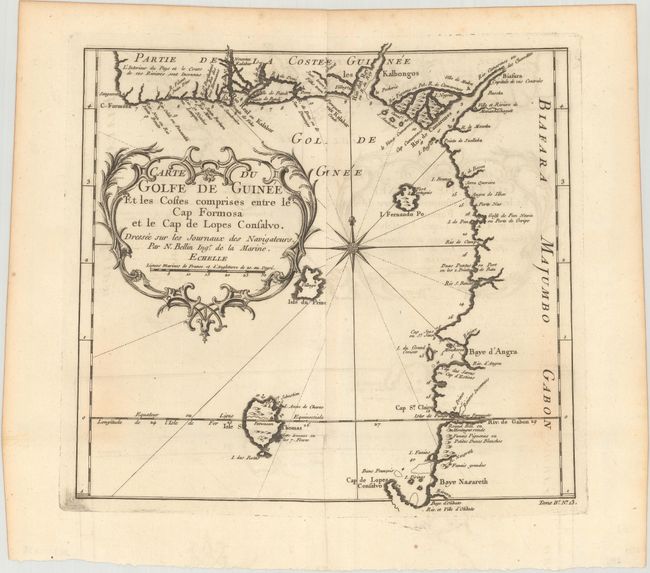
B. Carte du Golfe de Guinee et les Costes Comprises Entre le Cap Formosa et le Cap de Lopes Consalvo..., by Jacques Nicolas Bellin, from Histoire Generale des Voyages, circa 1760, black & white (11.1 x 10.3"). This attractive chart of the Gulf of Guinea shows soundings, anchorages, and good coastal detail. I. Fernando Po (Bioko) and Isle St. Thomas are located in the gulf, with Portuguese forts noted on each island. The chart is decorated by a large ornate title cartouche and compass rose. Condition: A dark impression issued folding on watermarked paper with light offsetting and some extraneous creasing along the centerfold. (B+)
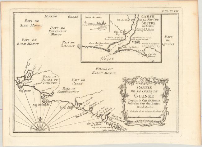
C. Partie de la Coste de Guinee Depuis la Cap de Monte Jusqu'au Cap des Basses, by Jacques Nicolas Bellin, from Histoire Generale des Voyages, circa 1760, black & white (8.3 x 6.0"). This small map presents a portion of the coast of present-day Liberia with little inland detail aside from the names of the various peoples of the region. An inset at the top depicts the Cestos River with soundings and other navigational information and an illustration of a canoe. There is a decorative rococo-style title cartouche at bottom right and a compass rose that radiates rhumb lines at bottom left. Condition: On watermarked paper with a minor spot at top left. (B+)
References:
Condition:
See description above.