Subject: Western Africa
Period: 1685-94 (circa)
Publication:
Color: Black & White
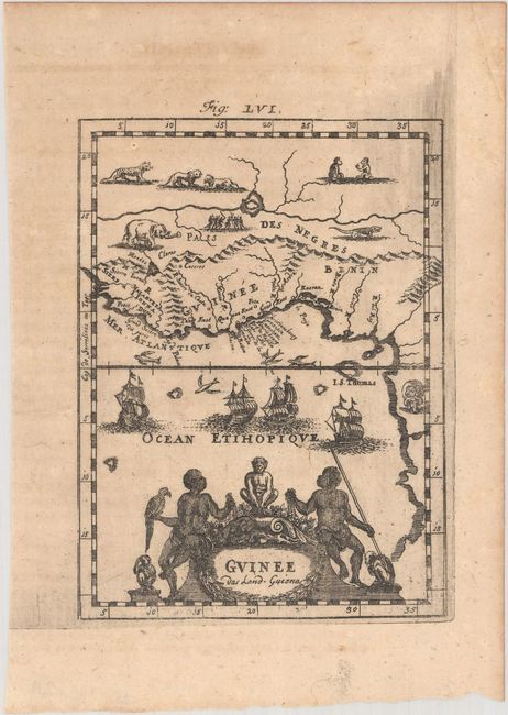
A. Guinee das Land-Guiena, by Alain Manesson Mallet, from Beschreibung des Gantzen Welt-Kreisses, circa 1685 (4.2 x 5.6"). A delightful small map of the western coast of Africa including Guinee, Benin, and Congo. The land is covered with lions, monkeys, elephants, and crocodiles, while the sea is filled with sailing ships and flying fish. The title cartouche includes natives, monkeys, and birds. Reference: Pastoureau, MANESSON-MALLET I B. Condition: Lightly toned with some printer's ink residue at top right. (B+)
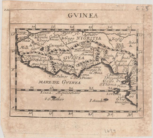
B. Guinea, by Duval/Beer, from Geographiae Universalis…, circa 1694 (4.9 x 3.9"). This miniature map of the west coast of Africa spans from Senegal to Cape Lopez, just below the equator.
Pierre Duval was Nicolas Sanson's nephew and pupil. He published a wide range of atlases and individual maps including a fine miniature world geography with many of the maps based on Sanson. This map is from the German edition of Duval's world geography. The maps were probably engraved by Sigismund G. Hipschman (as his signature appears on the title page and the world map) and have Latin titles rather than the original French. The maps are often attributed to Johann C. Beer, who translated the work into German. Refererence: King (2nd ed) pp. 132-135; Shirley (BL Atlases) T.BEER-1a #26. Condition: Issued folding with scattered damp stains and light toning. (B)
References:
Condition:
See description above.