Subject: Northern Asia
Period: 1749-80 (circa)
Publication: Histoire Generale des Voyages
Color: Hand Color
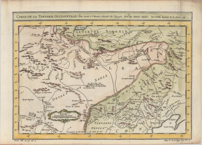
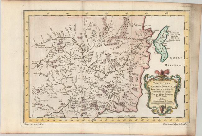
This pair of maps provides a very detailed view of the Tartary region of Russia. The maps are based on Jesuit surveys, the cartography of Ivan Kyrlov, and English maps of the region.
A. Carte de la Tartarie Occidentale pour Servir a l'Histoire Generale des Voyages Tiree des Auteurs Anglois (12.2 x 8.7"). This map covers western Tartary with a focus on the region of present-day Mongolia. This map includes information from Kyrkov's important surveys of this remote region in addition to Jesuit and English sources. It includes detail of the roads and shows sections of the Great Wall.
B. Carte de la Tartarie Orientale pour Servir a l'Histoire Generale des Voyages, Tiree des Cartes Levees par les P.P. Jesuites (12.1 x 8.3"). This map covers the eastern part of Tartary with part of present-day Manchuria and Sakhalin Island. The map was based primarily on Jesuit and English sources and is particularly detailed with regard to the river systems. Features a lovely decorative cartouche.
References:
Condition: A
A crisp impressions, issued folding on bright sheets with a bunch of grapes watermark and moderate soiling mostly confined to the right blank margins.